In the category of places we never imagined we’d be, Easter Island would be near the top of the list. And if the thrill of visiting that island territory in Chile wasn’t enough, during our last few weeks in South America we also had the opportunity to experience the majesty of Iguazu Falls on the border between Brazil and Argentina.

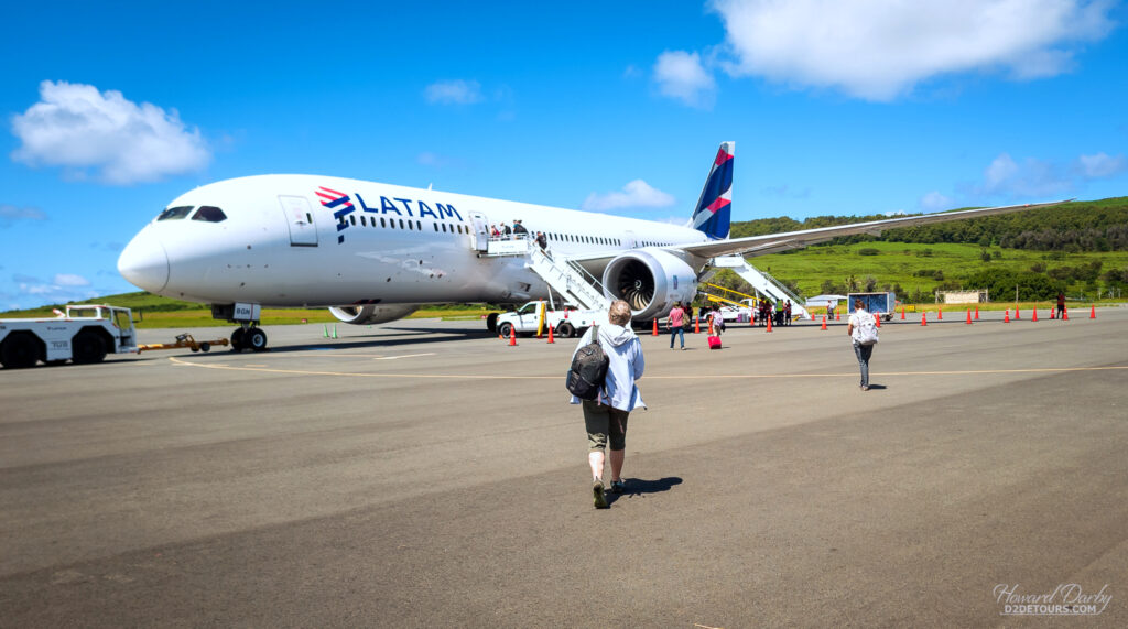
All flights to Easter Island go through Santiago, Chile, so before we embarked on that island adventure, we connected with friends from Calgary and spent several days sightseeing on the mainland, dividing our time between Santiago and Valparaíso.
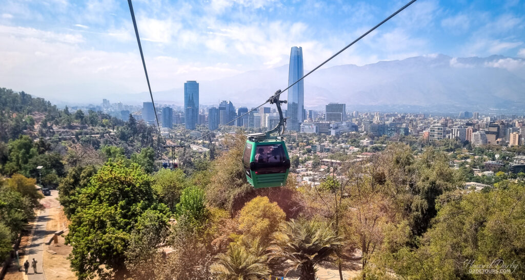
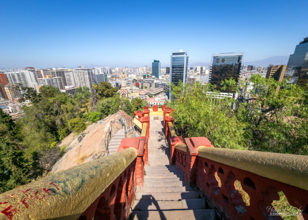
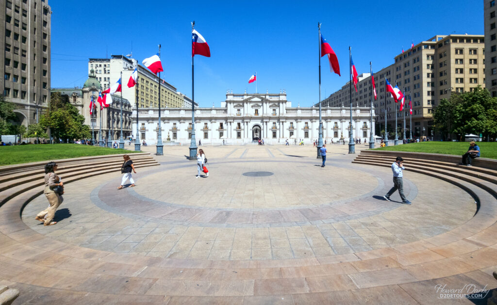
Santiago, founded in 1541, has served as the capital city of Chile since its inception. Forty percent of Chile’s population (7M) lives in the metropolitan region of Santiago, an area highly susceptible to earthquakes and tsunamis (most of the city is between 500-650 m / 1,640-2,133 ft above sea-level). Its architecture, like most of Latin America, reflects its Spanish colonial roots with a Plaza de Armas, surrounded by a church and administrative buildings, at its core.
We rented a car to reach Valparaíso, about 120 km / 75 miles northwest of Santiago, ensuring our route took us through the Casablanca Valley, where we had our choice of wineries from which to sample some exceptional Chilean wine. We stopped at the Viñedos Veramonte Altos de Casa Blanca and, in addition to savouring several glasses of wine on site (together with an excellent explanation of the varieties), we left with a few bottles to get us through the next couple of evenings.
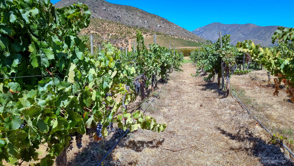
Fun Fact: Carménère, a member of the Cabernet family of grapes, is Chile’s signature red variety. The grape originates from the Bordeaux region in France and is considered one of the most ancient varieties in Europe. A phylloxera infestation in 1867 decimated European vineyards with Carménère grapevines being particularly affected. Efforts to replant those vines proved unsuccessful, and the grape was presumed extinct. Meanwhile, Chilean growers were patterning their burgeoning industry after France and in the 1850s were importing Merlot cuttings from Bordeaux. Unbeknownst to all involved, Carménère cuttings were getting mixed in with the Merlot exports. The “Merlot” produced from these grapes proved to be markedly different from Merlots produced elsewhere in the world, giving rise to the Chilean Merlot. It was not until 1994 that French ampelographist Jean Boursiquot realized that the grape was not a Merlot, but rather a distinct variety, and in 1998 it was officially recognized as Carménère.
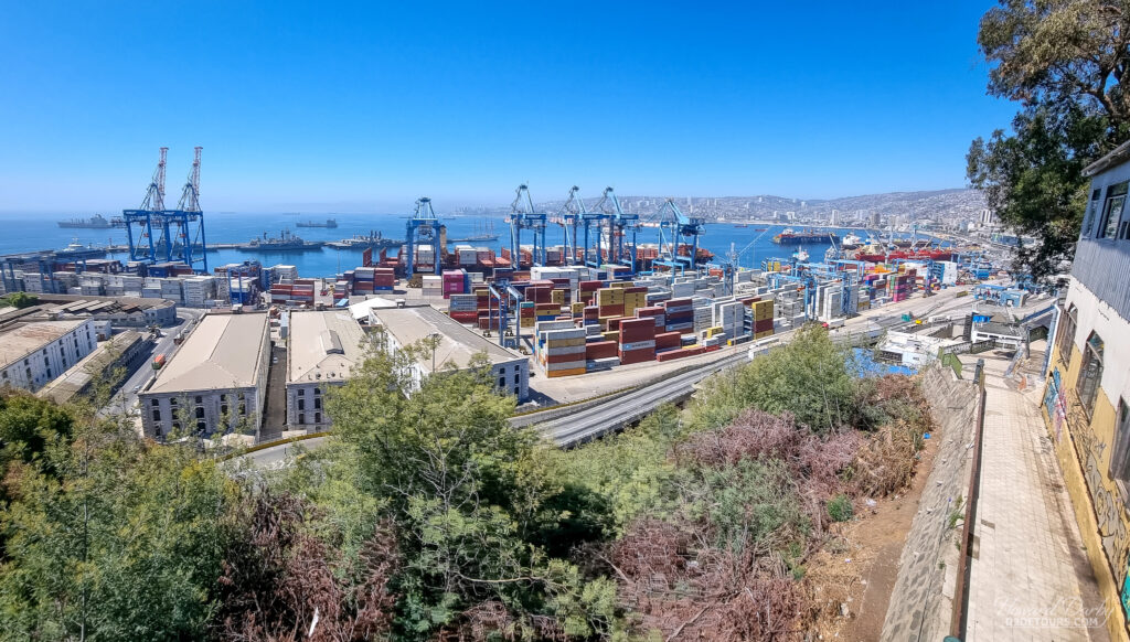
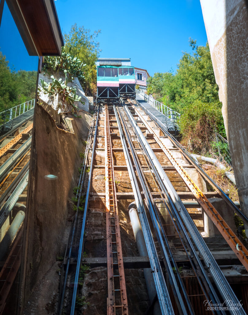
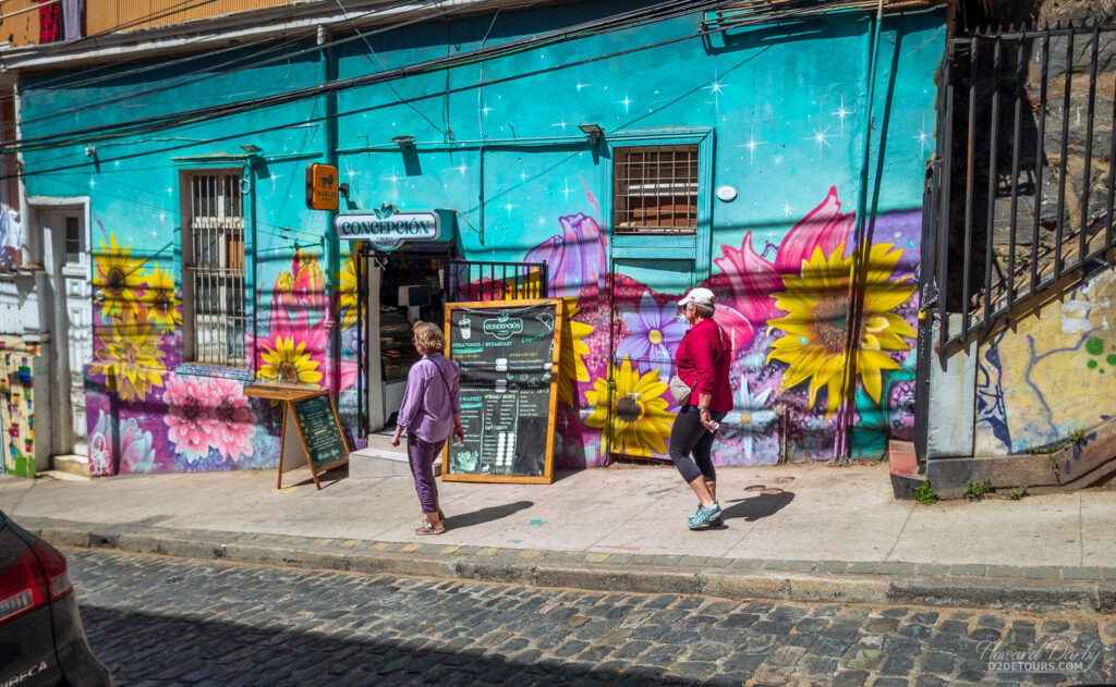
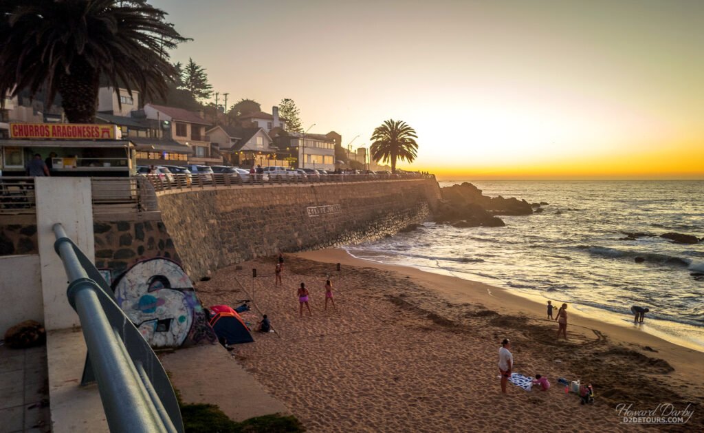
Wine production was not the only rapidly growing sector in mid-19th-century Chile. Valparaíso, which, since 1817, had been the headquarters for the Chilean Navy, was becoming an increasingly important layover for ships travelling between the Atlantic and Pacific oceans via the Straits of Magellan. As an international trading hub, business opportunities were plentiful, and European immigrants began arriving en masse. Latin America’s oldest stock exchange, the continent’s first volunteer fire department, and Chile’s first public library all owe their beginnings to the golden age of Valparaíso. The opening of the Panama Canal in 1914 brought an end to all that prosperity. Today it is a quirky seaside town, full of funiculars and funky street art.
And now to Rapa Nui (Easter Island). Located 3700 km / 2300 miles west of the Chilean mainland, it is one of the most remote inhabited islands in the world – its nearest neighbour (2075 km / 1289 miles away) is Pitcairn Island, which has a massive population of 50.
There are differing views as to when Polynesian inhabitants first arrived on Rapa Nui. Most experts believe they arrived in or around 800 CE, but a compelling study from 2007 suggests their arrival might have been much later, closer to 1200 CE. Regardless of their arrival date, they created a thriving culture lasting for many generations until land clearing for cultivation in the mid-17th century led to complete deforestation. That was just the beginning of their struggle for survival. Disease brought by European settlers in the 18th century, Peruvian slave raiding in the 1860s, and emigration to Tahiti had reduced the native population to barely 100 inhabitants by 1877.
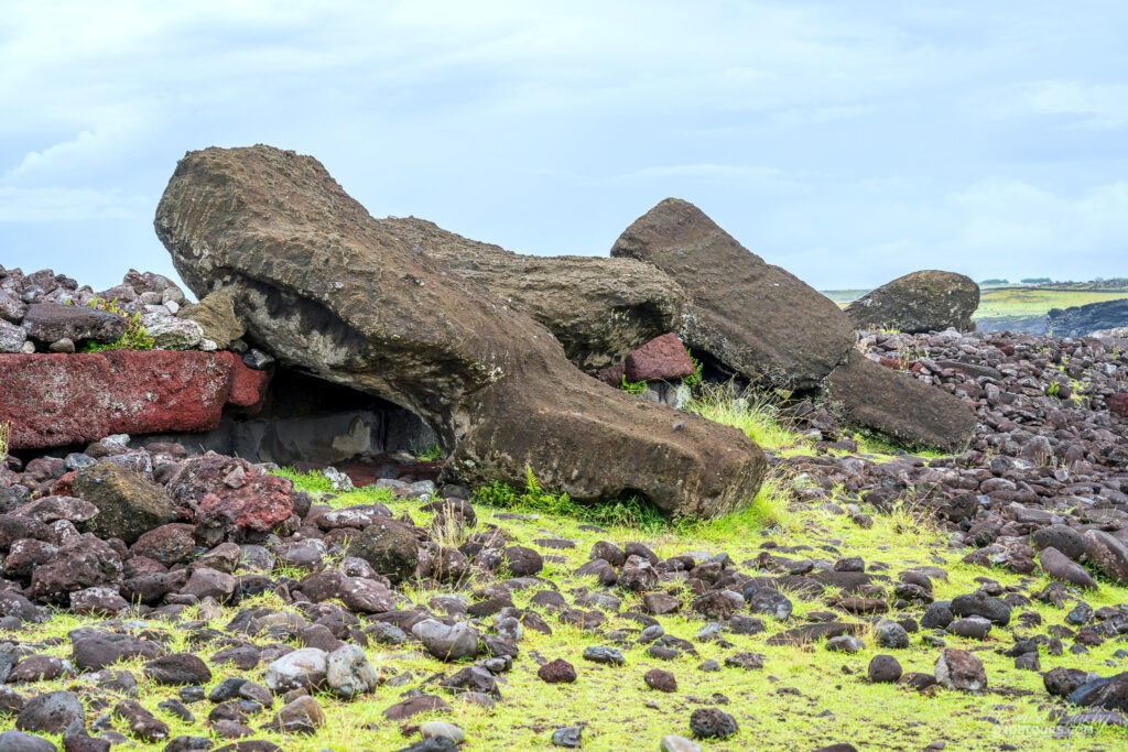
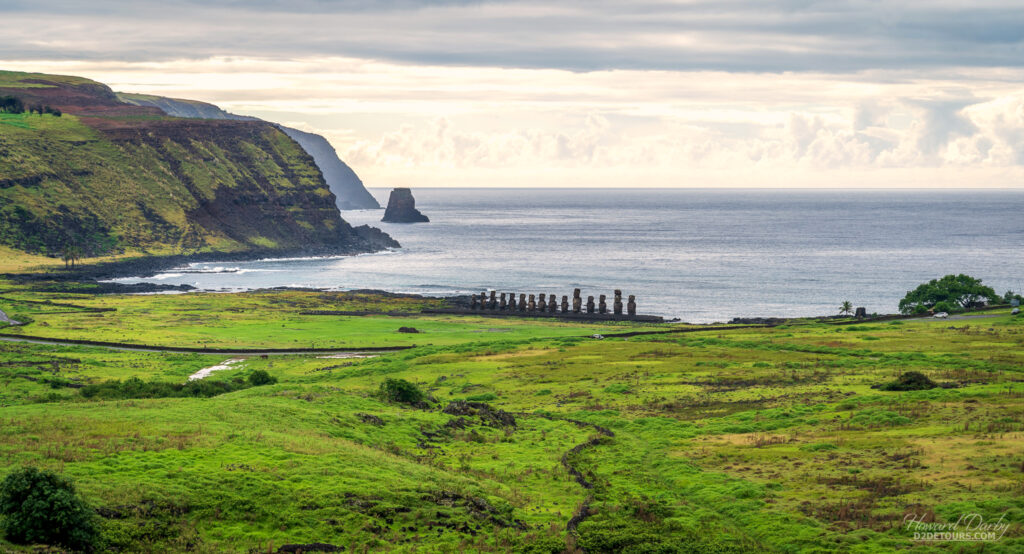
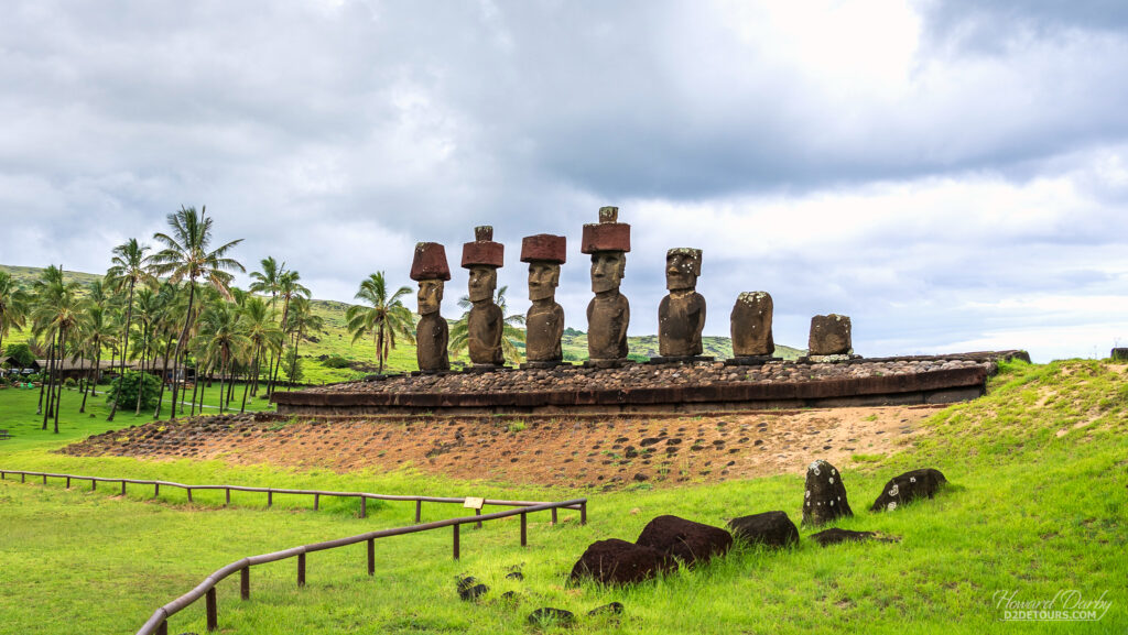
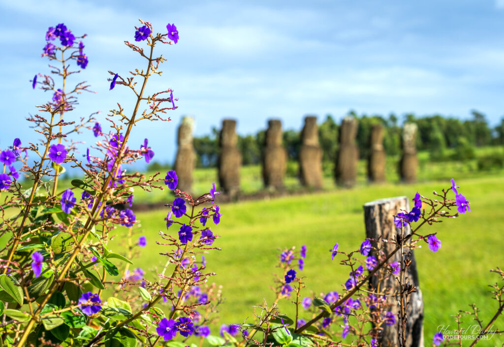
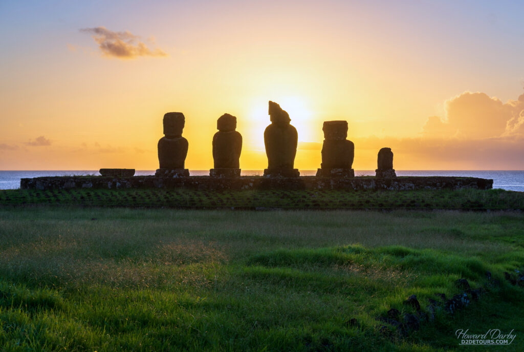
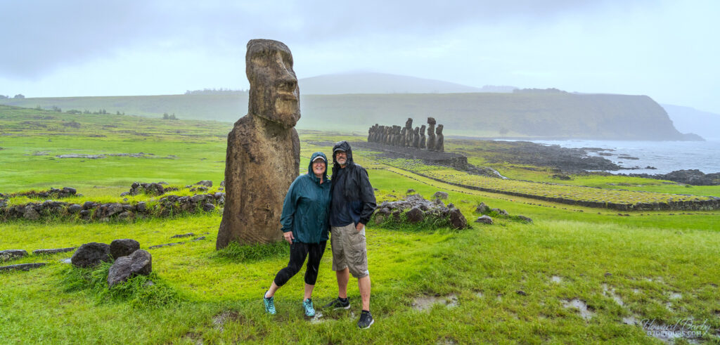
The island was annexed by Chile in 1888, and the Rapa Nui were granted Chilean citizenship in 1966. Today the island’s population is roughly 7750 with less than half (45%) identifying as Rapa Nui. The monolithic moai (mo-aye) for which the island is best known, date from 1250 to 1500 CE. These stoic statues are a form of ancestral worship, and, although to the untrained eye it’s a little hard to tell, have distinct features representing deified ancestors, usually chieftains who were believed to have descended from the gods and possessed supernatural powers. Gazing inward across their clan lands, these statues were still standing when the first European, a Dutch explorer, discovered the island in 1722, and when Spain claimed the island in 1770. By 1774, when James Cook arrived, most of the moai had been toppled, which has led scholars to various theories: intertribal warfare, loss of faith in their ancestors to protect them, or religious conversion.
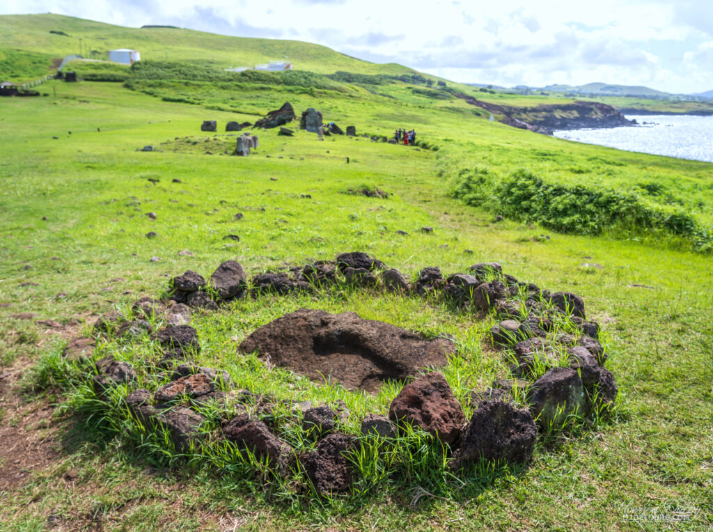
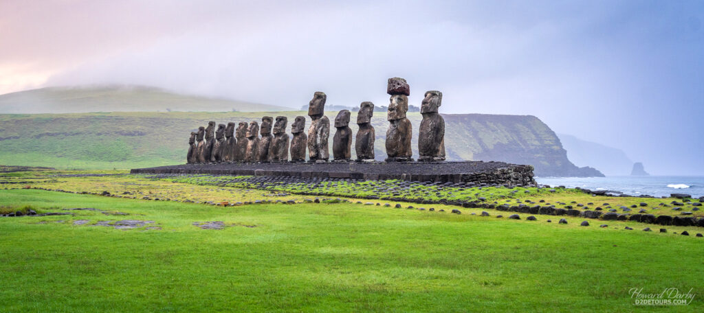
Restoration efforts began in the 1960s. Ahu Tongariki, with its 15 moai, was restored between 1992 and 1995, thanks to a generous donation from the Japanese. Japan, in conjunction with UNESCO, continues to fund a great deal of the ongoing conservation efforts.
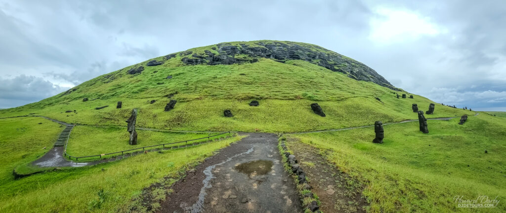
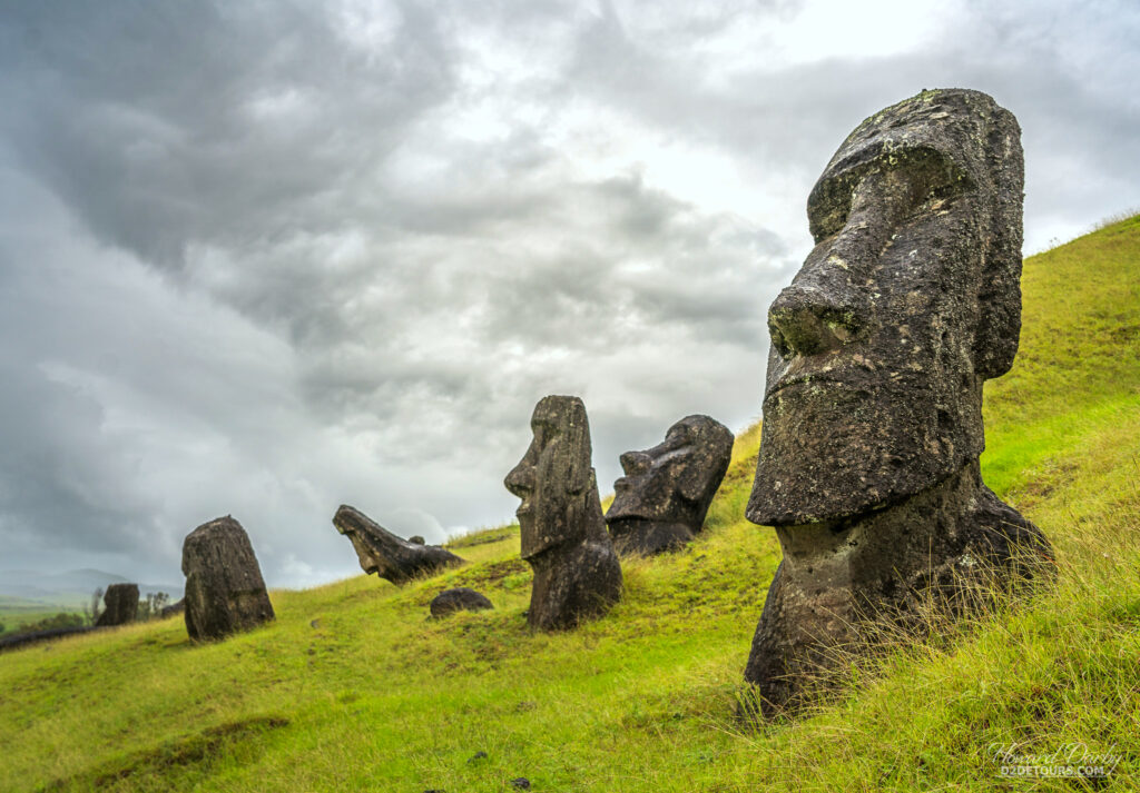
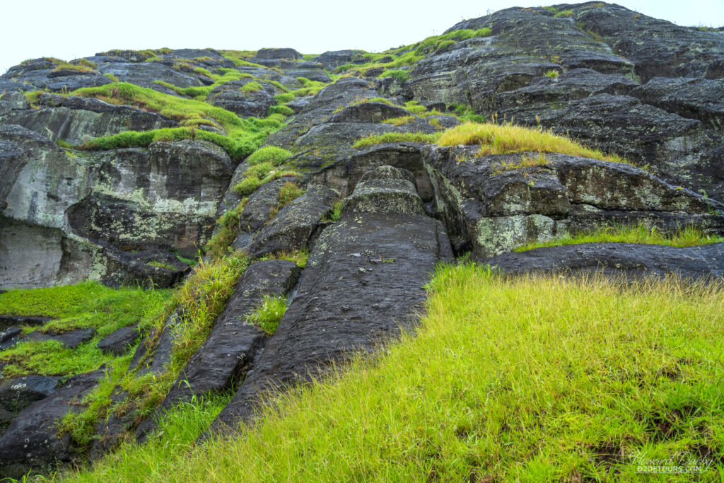
Most of the island’s moai (900 have been identified, with more being discovered) have been carved from the volcanic tuff in the Rano Raraku quarry – Rapa Nui’s tuff is hardened volcanic ash that formed following an eruption three million years ago. The human-like figures, complete to the waist with arms and hands spread across the belly, would have first been outlined in the rock wall, then the tuff was chipped away to release the final three-dimensional image.
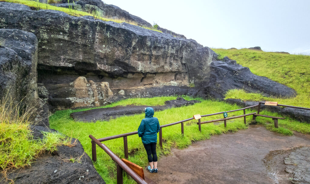
The three-to-five ratio between the head and body of the statues is consistent with the Polynesian belief in the sanctity of the head. The average height of a moai is about 4 m / 13 ft, with a base around 1.6 m / 5.2 ft, and a weight of 12.5 tonnes. The tallest moai, which stands on the Ahu te Piro Kura platform, is 10 m / 33 ft high and weighs 82 tonnes. The heaviest, albeit shorter, moai weighs in at 86 tonnes and stands on the Ahu Tongariki platform. An unfinished sculpture still at the Rano Raraku quarry would have stood 21 m / 69 ft tall and weighed between 145 and 165 tonnes. Speculation is that those responsible for moving these behemoths told the stone craftsmen relocation of that particular ancestor was not doable. The finishing touch on the moai was the eyes. In 1979, after collecting and reassembling fragments of white coral scattered about various moai platforms, a team of archaeologists determined that the deep elliptical eye sockets were intended to hold coral eyes with either black obsidian or red scoria pupils. It has also been surmised that this step was completed once the moai had reached their final destination.
So how did they get these colossal stone sculptures from the quarry to the coastline surrounding the island? Early researchers assumed it was done with wooden sleds or rollers, and significant human energy. A recent study, however, demonstrated it is possible to raise the statues upright, then harness them with ropes, and by tilting them side to side while pulling forward “walk” the moai to their final positions all over the island. That theory has some support in the oral histories of the island, wherein divine power was called upon to compel the statues to walk.
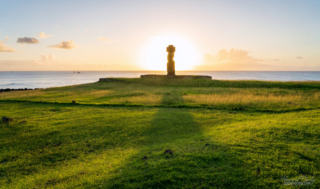
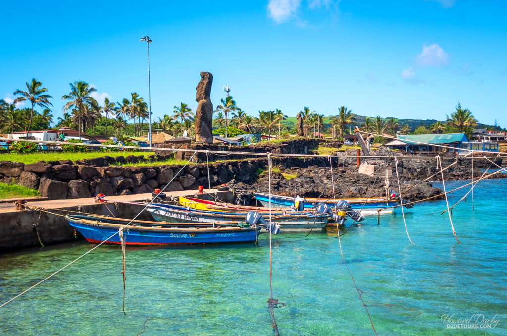
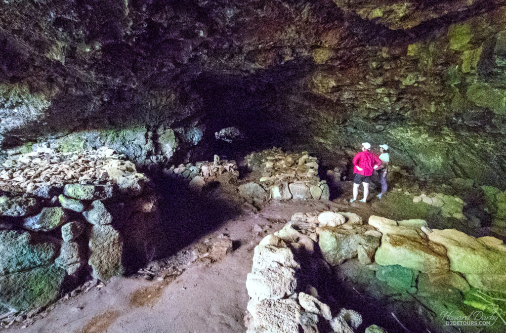
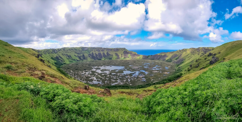
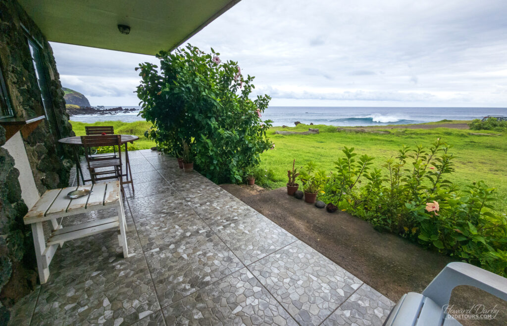
Whichever method was used, these silent sentinels are an amazing sight to behold. The whole island is gorgeous with a coastal landscape that is more suitable for photography than swimming. And while no endemic tree species can be found on the island today, reforestation efforts are ongoing with eucalyptus and palm trees proving to be successful imports.
From Easter Island, we made our way to the opposite side of the South American continent, landing in Buenos Aires, Argentina.
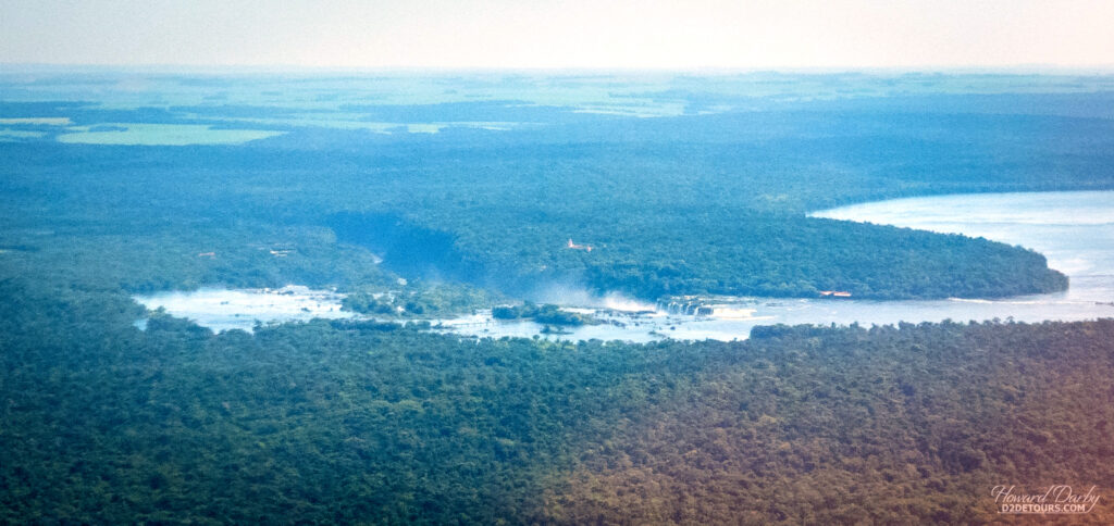
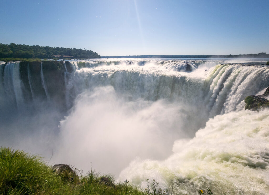
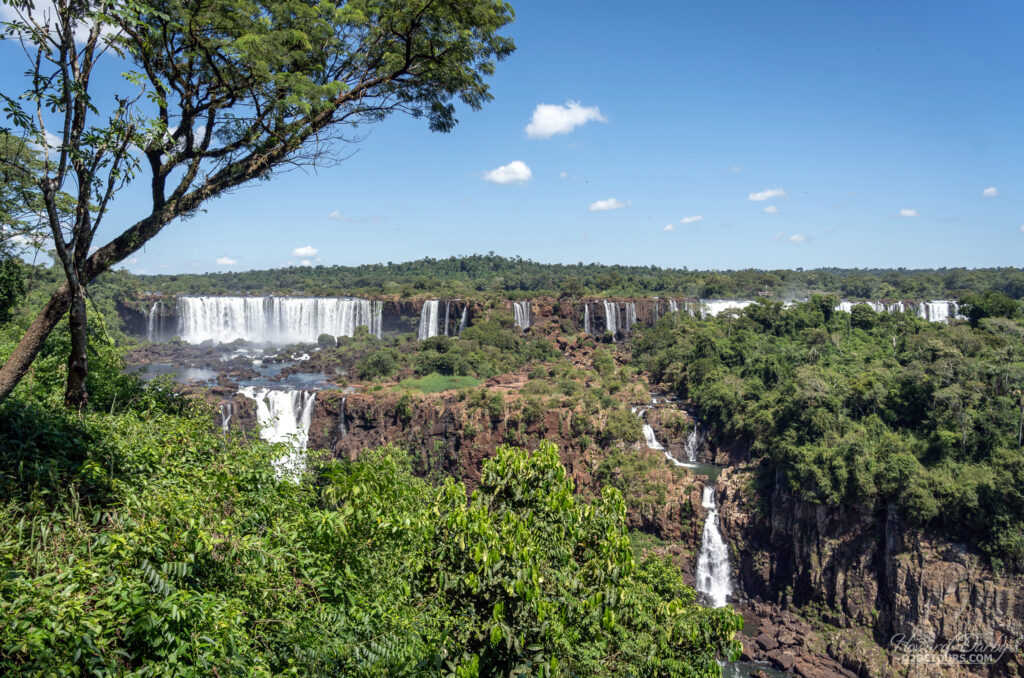
Before we spent any great length of time in Buenos Aires, we took a side trip to Iguazu Falls, the largest waterfall system in the world. The falls are located on the border between Argentina and Brazil, with 80% of the falls on the Argentinian side.

Click the Instagram post below to play a video of the falls…
View this post on Instagram
A Spanish explorer, in 1542, first referenced the location of the falls. Jesuit missionaries who were evangelizing the Guarani tribes between 1608 and 1767 “discovered” the falls, but it was Gregorio Lezama, an Argentinian explorer, who laid claim to the land in 1882. He very quickly sold his stake at auction, noting the land was “a block of jungle that borders several waterfalls.”

The new owner quickly put up a hotel and laid a road, hoping to attract some visitors, but mainly he just exploited the timber reserve. In 1902, the land was “acquired” by the government, and the creation of a park was recommended. In 1934, this block of jungle with some waterfalls became a national park and was declared a UNESCO World Heritage Site in 1984.
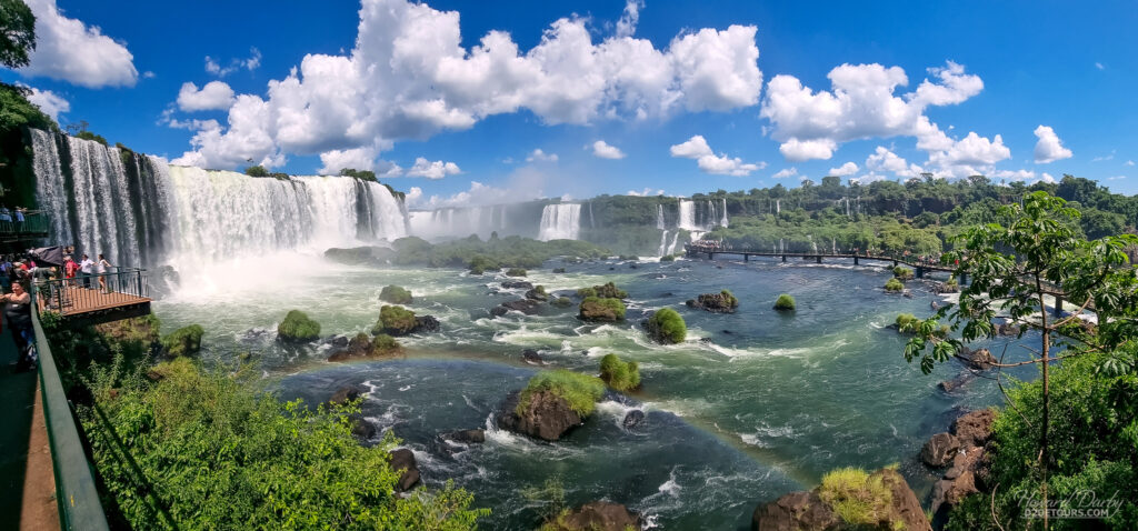
There are no words to truly capture this jaw-dropping spectacle; pictures can’t begin to do it justice. It is stunning. We opted to visit both sides of the falls (Brazil then Argentina the next day), which gives two very different perspectives. Because most of the falls are on the Argentine side, viewing them from Brazil gives you a sense of the immense scale of this water system. From the Argentine side, you get to appreciate the power, and we were able to get right up into the mist in the section known as Devil’s Throat – an incredible experience.

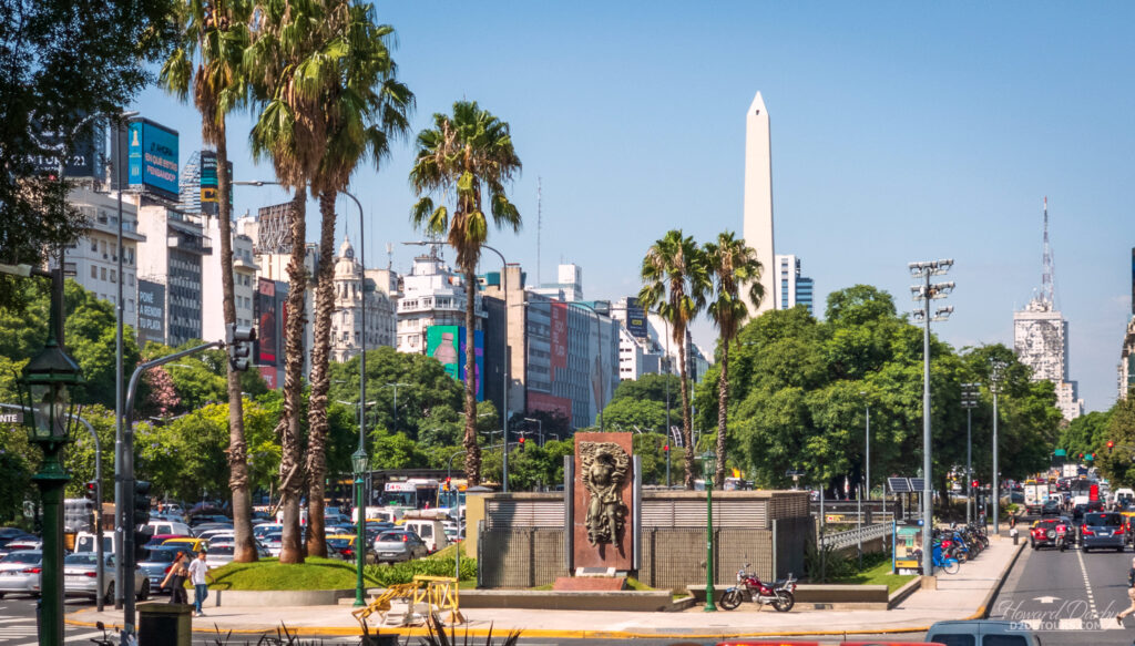
Surprise, surprise, Buenos Aires is another city founded by the Spanish, although it took nearly 70 years before they established a permanent settlement. The first settlement, Ciudad de Nuestra Señora Santa María del Buen Ayre (City of Our Lady Saint Mary of the Fair Winds – the Spanish conquistadors sure did like extravagant names) was established in 1516.
The locals in this part of the Americas were rather feisty, and by 1542 had forced the settlers to abandon the city. Undeterred, by 1580 the Spanish brought the city firmly back into the fold. Like many colonial settlements, Buenos Aires’ existence depended primarily on trade. Trouble was, during much of the 17th century, piracy was a huge problem for Spain. Their solution was to provide military protection for convoys departing from Seville to Lima, Peru, and from there, goods were disbursed (by land) to the rest of the colony.
It took a loooong time for products to arrive in Buenos Aires, and when they did, transportation costs made them prohibitively expensive. The Portuguese (in Brazil) were happy to step in, and a thriving contraband industry (largely ignored by local authorities) took root. The porteños (port city people, a term used to describe the Buenos Aires traders) were deeply resentful of Spain’s lack of interest in their predicament. In 1776, to placate Buenos Aires, the King of Spain created the Viceroyalty of Buenos Aires and declared its port open for business. Despite these concessions, many of the porteños, who were keenly aware of what was transpiring in the rest of the world, felt the time had come to declare independence from Spain. It didn’t happen overnight; Argentina finally declared its independence in 1816. The dominos of Spanish colonization began to fall: Chile in 1818, Colombia in 1819, Mexico and Peru in 1821, Ecuador in 1822, and lastly Bolivia in 1825 (Venezuela had previously declared their independence in 1811).

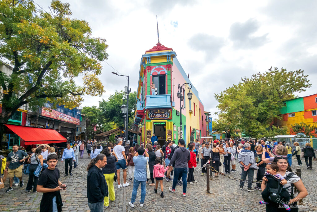
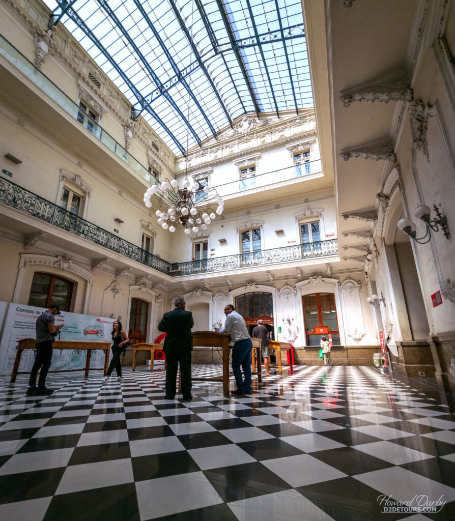
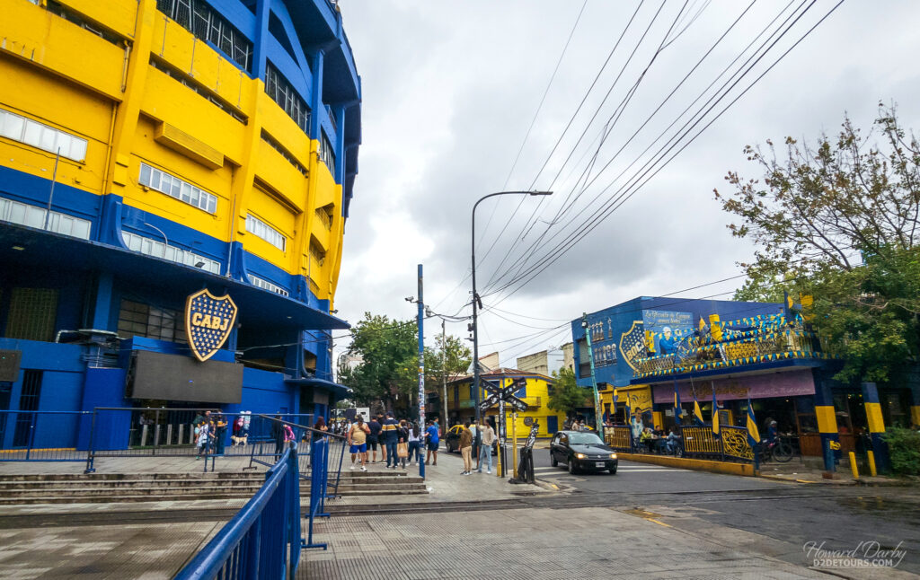
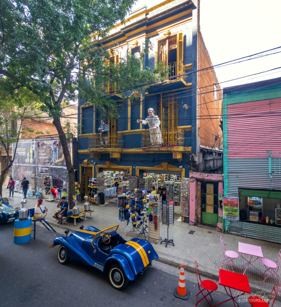
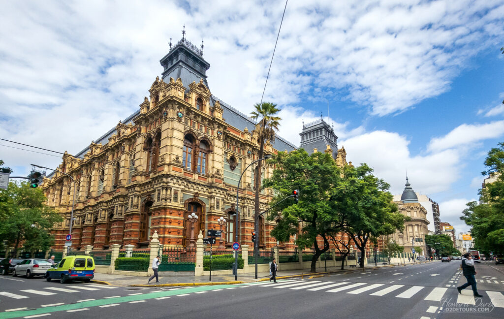
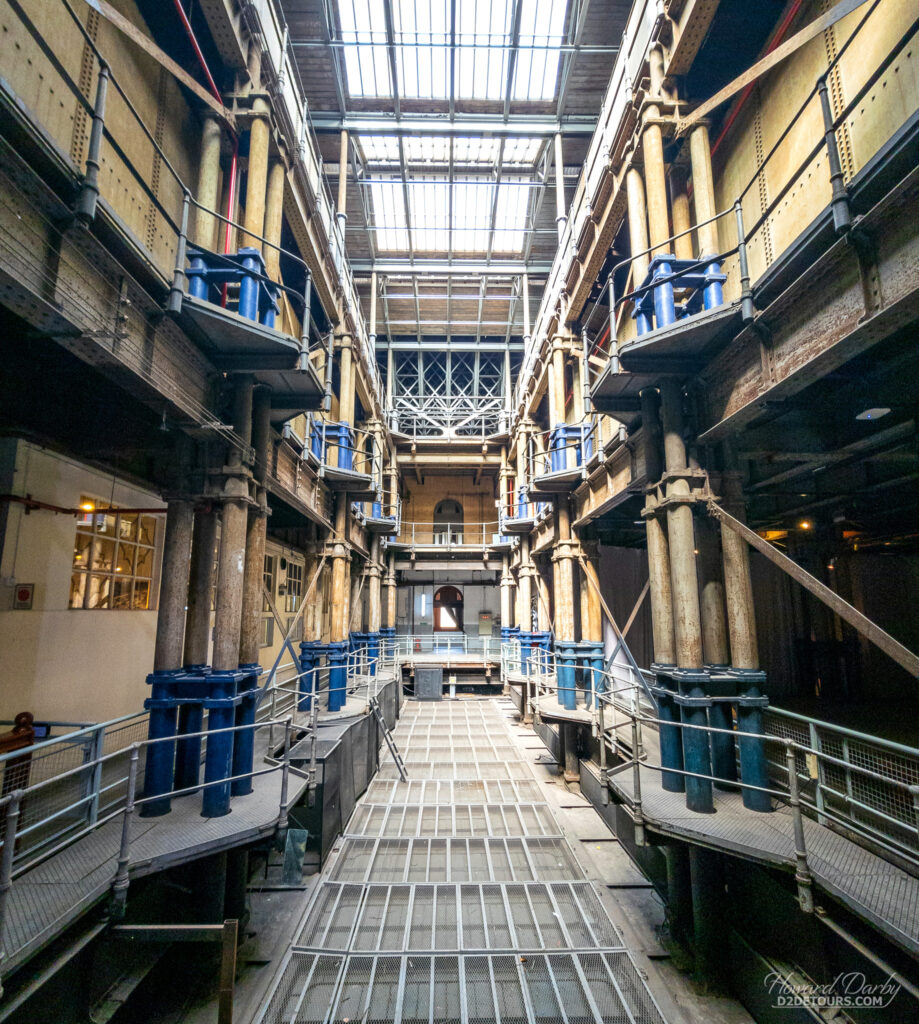
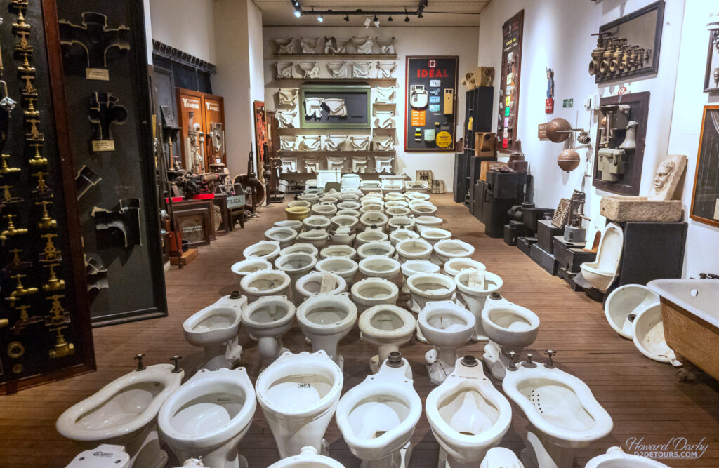
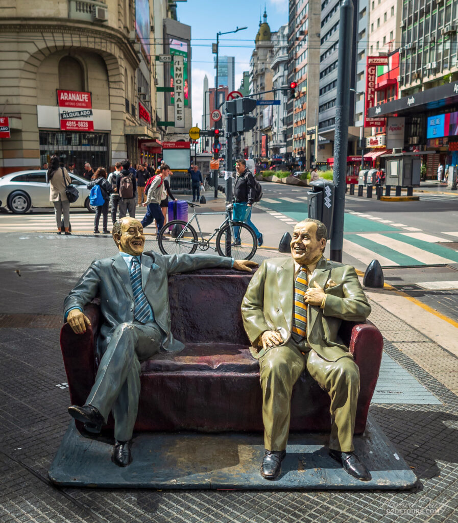
Buenos Aires is a very walkable city and we enjoyed exploring the different neighbourhoods. One afternoon we walked past this impressive looking building that we were sure must have been a former palace. A quick check of Google Maps showed it included the Museum of Water and Sanitary History, with a free entry fee, so in we went! This purpose-built palatial building housed the city’s water pumping station which operated from 1894 until 1978!
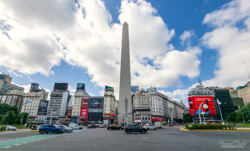
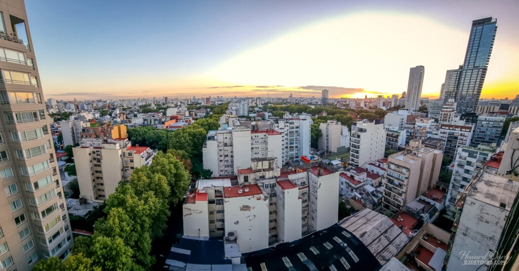
We very much liked Buenos Aires. It is a vibrant city, with a rich cultural heritage, an attractive mix of architectural styles, distinct neighbourhoods, and tons of green space – over 250 parks and green spaces! Off on a 22-day cruise to Europe!


What a detailed and FULL blog post. It looks like this was a wonderful and memorable trip.
What a great place to celebrate a milestone birthday ❤️