When we first started looking into travelling around Peru, the same bus line kept popping up: PeruHop. Essentially, this company offers a hop-on/hop-off experience along a designated route.
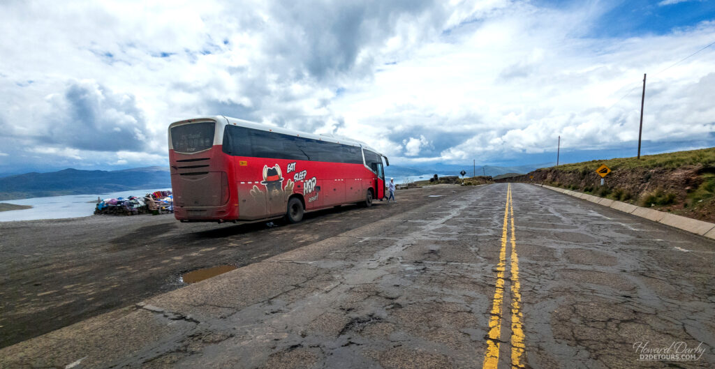
As the passenger you are responsible for booking all of your own accommodation, but have total control over how many nights you want to spend in each stop thus creating a customized transportation schedule. As long as you give 24 hours’ notice, you can make changes to your itinerary through the PeruHop app – which we did after the first of two overnight legs. Despite the large, semi-reclining seats, we did not feel the need to repeat the overnight experience, a choice punctuated by the fact that we think we almost got hit by a train. As we rumbled across some train tracks a blinding white light and ear-piercing whistle shattered the pitch black night – seemed the bus driver might have been trying to beat the train at the crossing!
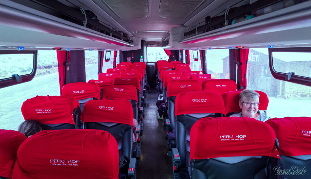
We opted to spend three nights in Lima before embarking on our land excursion, allocating 12 nights to get from Lima to Cusco (Machu Picchu), which also included a side trip to La Paz, Bolivia, with PeruHop’s sister company, BolviaHop. The service both PeruHop and BolviaHop offer includes not only the transportation between cities, but also shuttle buses that pick you up (or drop you off as the case may be) on the doorstep (or pretty darn close) of your chosen hotel/Airbnb, all while keeping you apprised of any delays through WhatsApp. They also include some interesting sightseeing opportunities along their routes (free with your bus ticket) and offer several paid excursions if you opt for an overnight stay in any of their designated city stops. It was extremely well-organized and took all the guesswork out of our travel logistics.
So, to which cities did we hop, and what did we see …
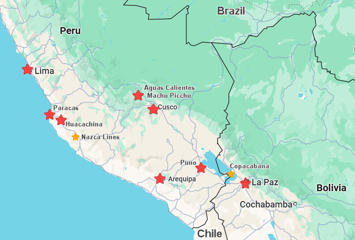
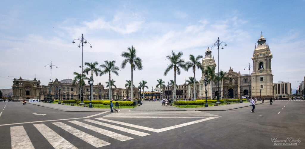
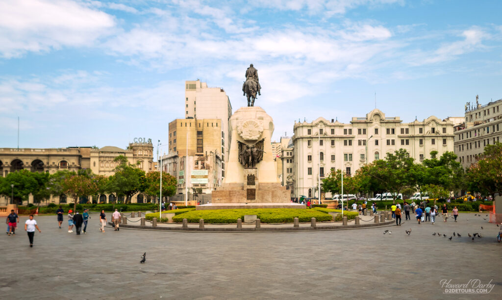
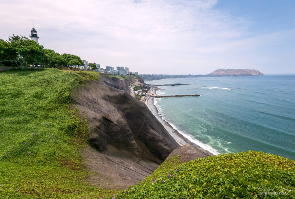
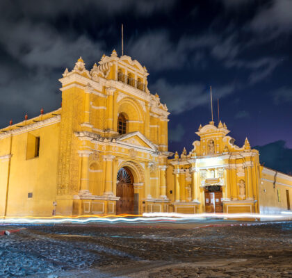
We started with three nights in Lima, which is not nearly enough time to get any real sense of this city of 11.5M, but we did like the little we saw. We stayed in the rather affluent Miraflores District, an area that was once home to a pre-Incan civilization known as the Limaq culture (100-650 CE). The Cuidad de los Reyes (City of Kings) was founded in 1535 CE, but that name quickly fell into disuse, being replaced by the Spanish pronunciation of the native name for the area, Limaq. Lima was the political, administrative, religious, and economic capital of the Viceroyalty of Peru, and one of the most important cities in Spanish South America.
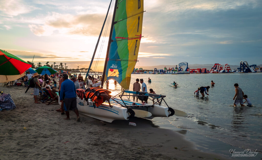
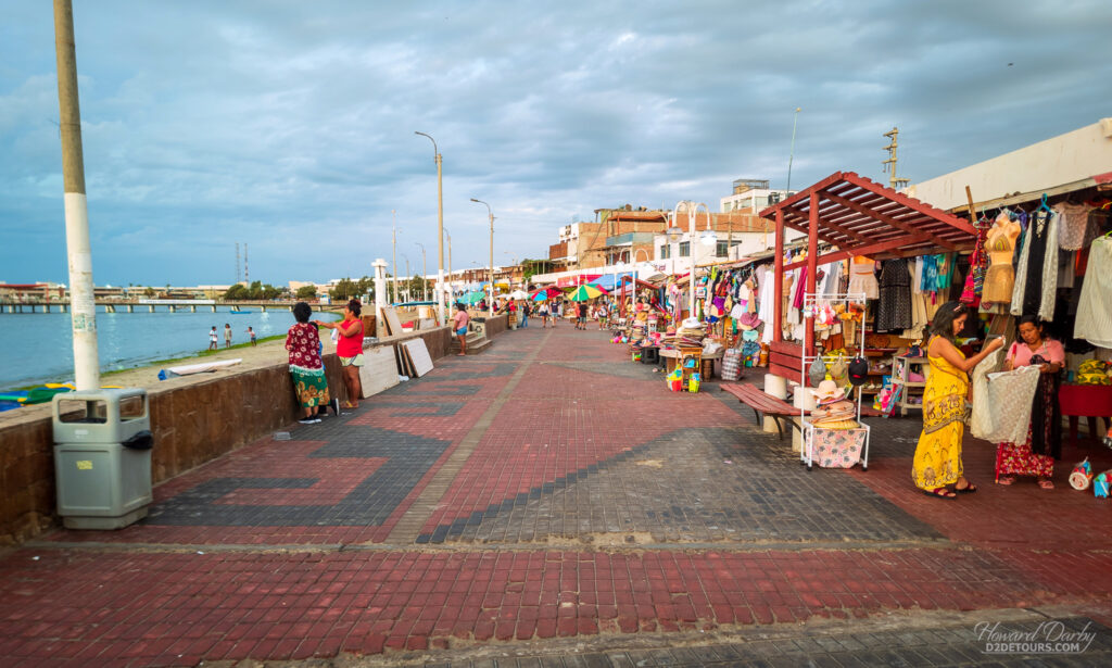
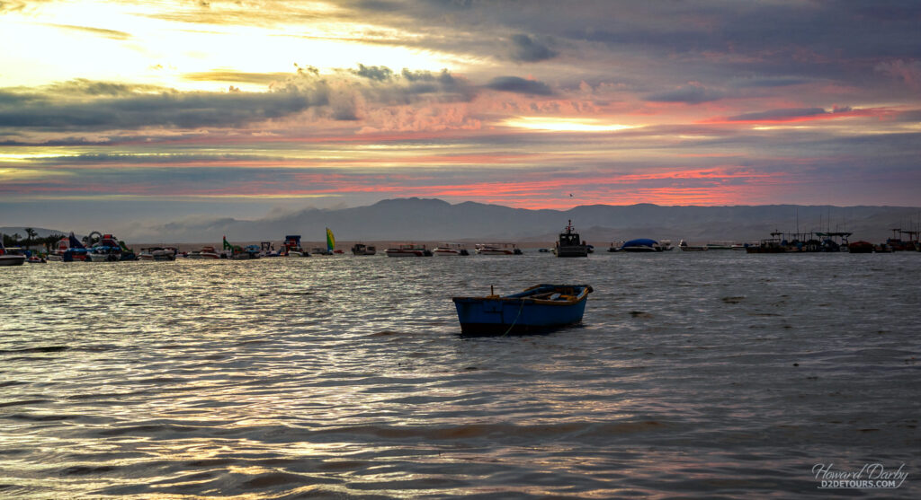
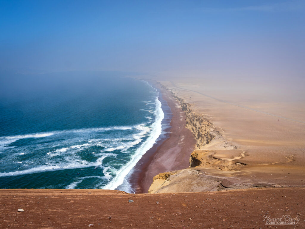
From Lima, we headed south to spend one night in the small coastal town of Paracas, just outside the Paracas National Reserve, a unique blend of desert and marine landscapes. Roughly 335,000 hectares in size, most of the reserve (200,000 hectares) is in the Pacific Ocean, and the remaining land area, on the edge of the Ica desert, is one of the driest and most rugged areas on earth.
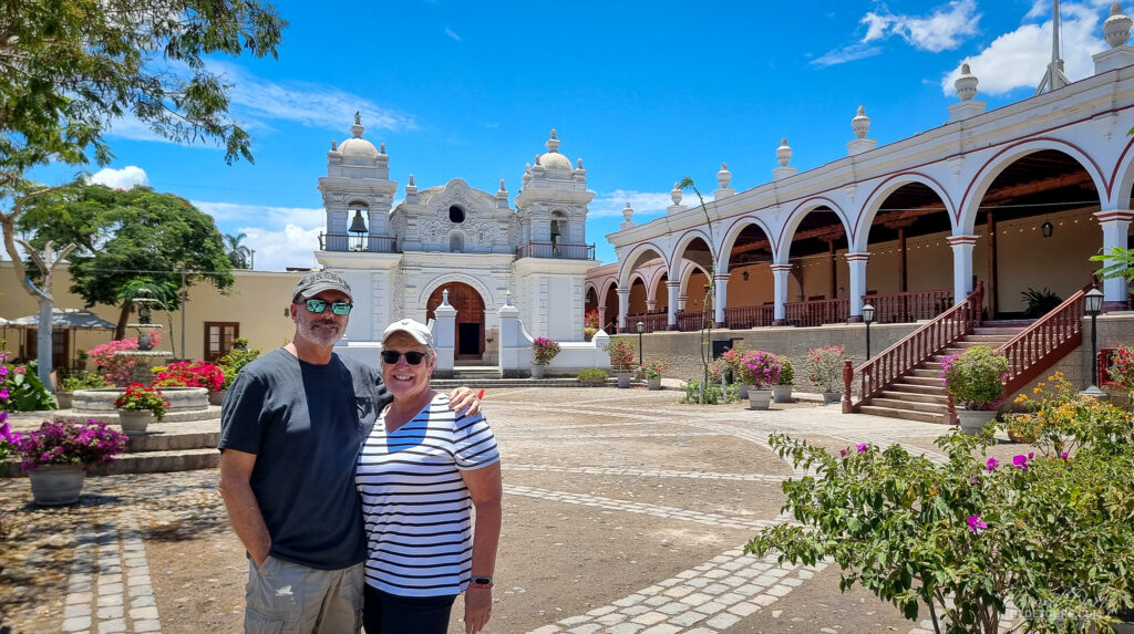
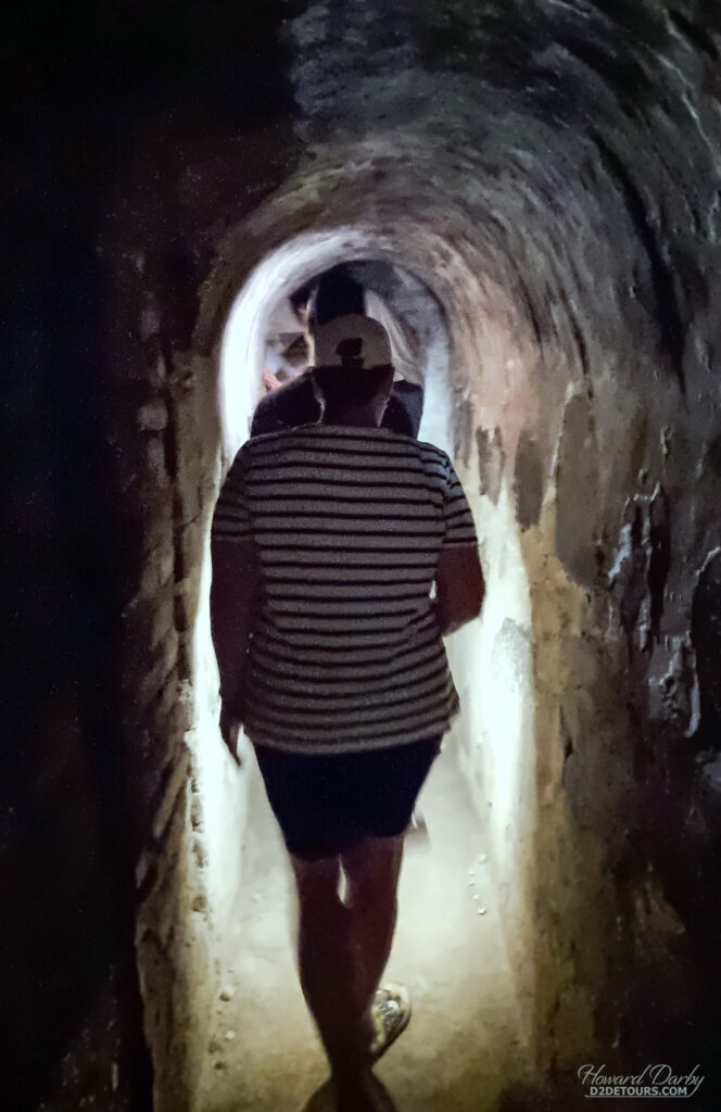
En route to Paracas, we stopped at the Hacienda San Jose, a former cotton plantation that is now an upscale hotel. Beneath their floorboards is a network of tunnels (roughly 32 km / 20 miles in length) that had once been used to smuggle slaves from the coast (17 km / 10.5 miles away) to the awaiting plantations. While slavery was legal in 17th-century Peru, that legality came with taxes, and these tunnels effectively hid this enslaved workforce from the tax collector.
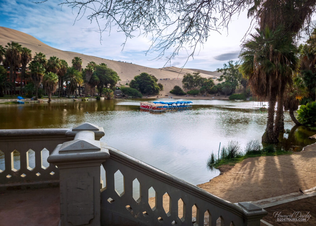
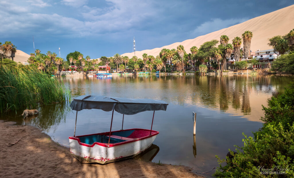
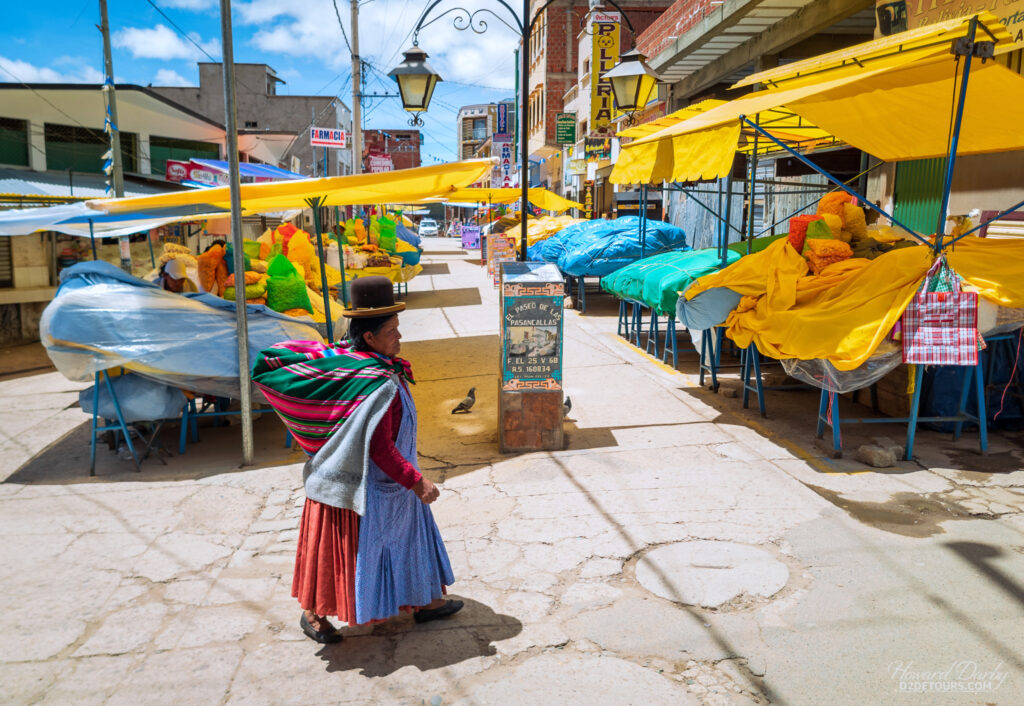
After Paracas, we spent one night in Huacachina, a desert oasis surrounded by some of the highest dunes we’ve ever seen. Honestly, we thought this tiny enclave was a bit of a dump and a total tourist trap.

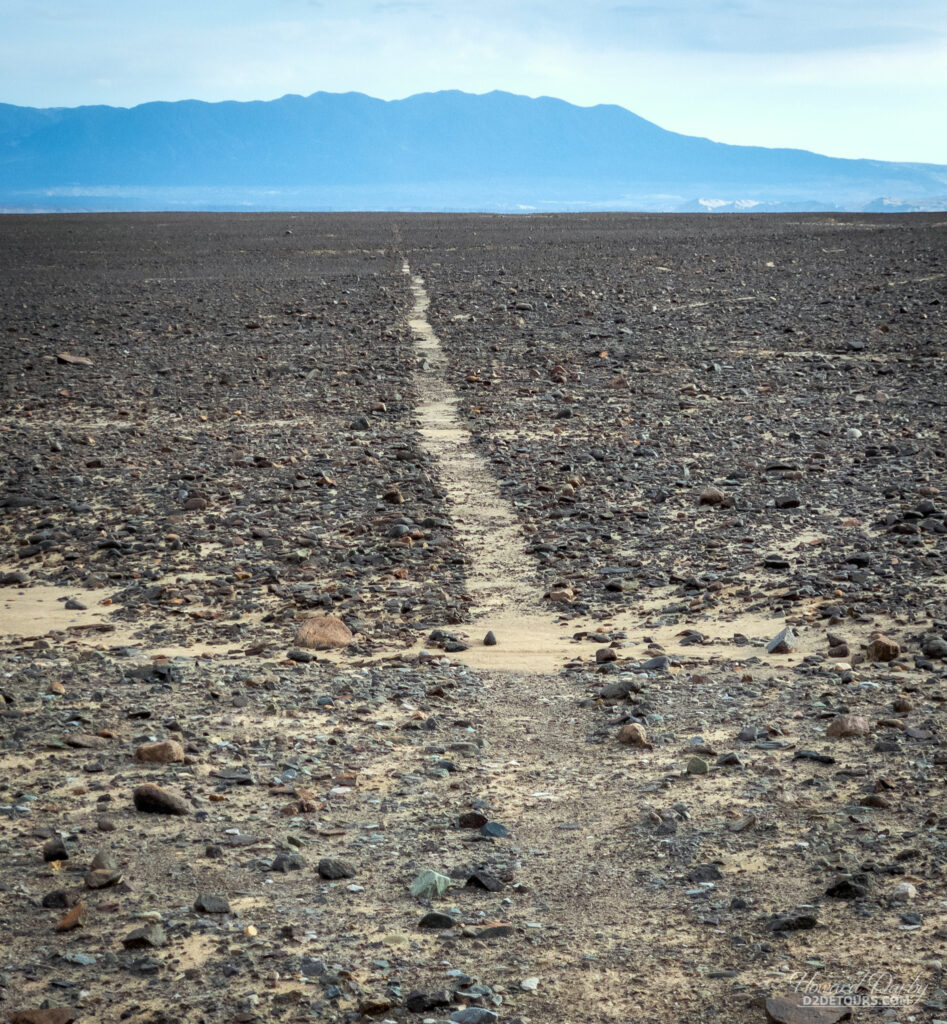
From Huacachina, we began a long overnight leg trip to Arequipa, which was broken up by a stop at a Nazca line viewing tower. Currently, 700 geoglyphs have been discovered in Peru, with more being discovered regularly through the use of drones. These lines vary in complexity: some are simple lines, some geometric, and some zoomorphic. They were created between 500 BCE and 500 CE, and if you were to combine their lengths into a single line, it would cover a distance of more than 1,300 km / 800 miles. These curious lines were made by scraping away the top layer of reddish-brown soil to reveal the yellow-grey subsoil. The depth of these lines is between 10-15 cm / 4-6 inches, with widths ranging from 33 cm / 13 inches (most common) to as much as 1.8 m / 6 ft.
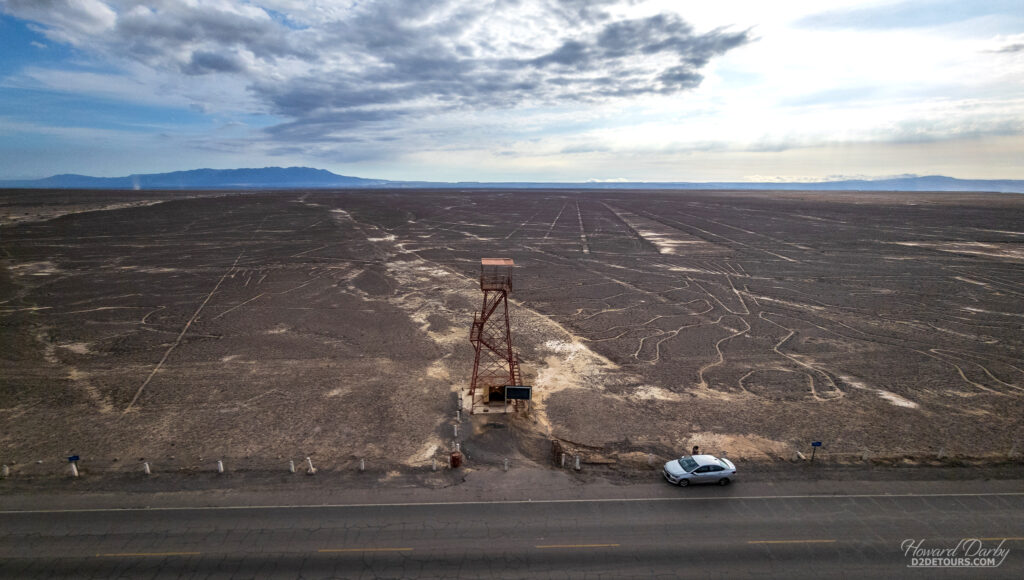
Recent archeological work has confirmed that with the tools and technology available at the time, the designs could easily be created within just a few days. A Spanish conquistador first noted these lines in 1553, describing them as trail markers; a later explorer thought they must be remnants of a road. The minimal rainfall and lack of wind in this desert climate have prevented significant erosion of these lines, leaving us to ponder their true purpose. Perhaps they were cultural or religious, maybe part of a complex agricultural system, possibly related to celestial observations, but what most scholars can agree upon is that they are not alien landing strips as proposed by the 1970s book Chariots of the Gods?.
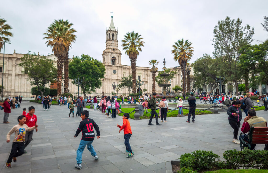
After several days hopping through Peru, we were very happy to settle in Arequipa for four nights.
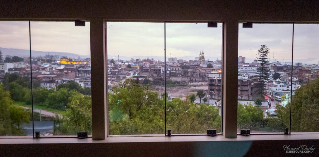
With a population of just under 1.3M, it is the second most populated city in Peru. It was founded in 1540 and given the name of “Beautiful Villa of Our Lady of the Assumption.” One year later, the Spanish King declared it should just be called City of Arequipa. Local tradition says that the name “Arequipa” comes from the Quechua phrase, Ari, qhipay (“yes, stay”), as supposedly when the first Spaniards arrived in the valley they asked the local chieftain what this land was called and he misunderstood their question as asking for permission to stay (bet they regret that offer now!). Sounds eerily similar to how Canada got its name: kanata is the Huron-Iroquois word for village or settlement. Arequipa’s nickname is the White City, as most of its historical buildings are constructed from sillar, a white volcanic stone. The lightly coloured buildings contrasted with the dark cobblestone streets make it a very pretty city to meander through.
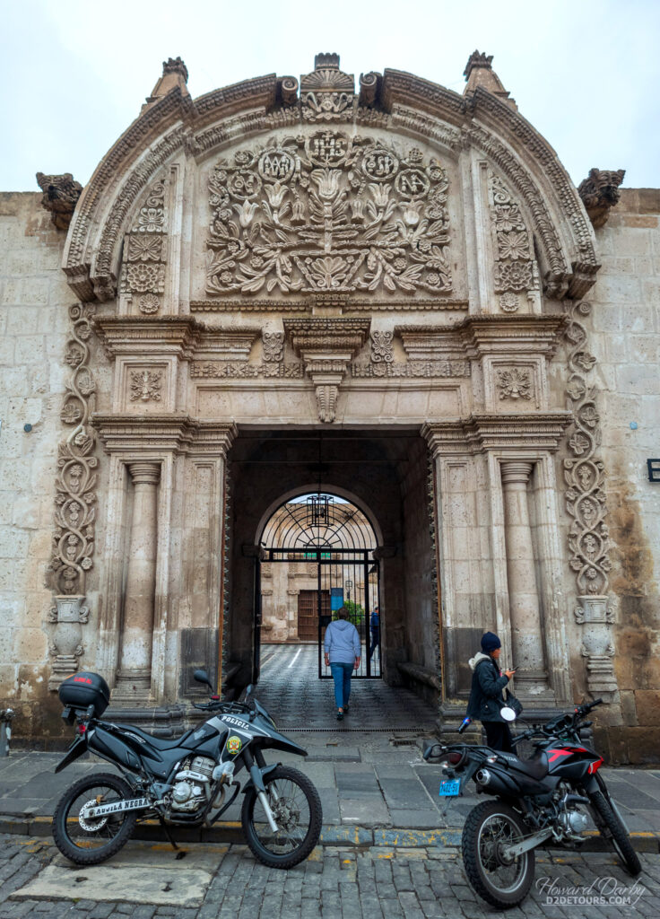
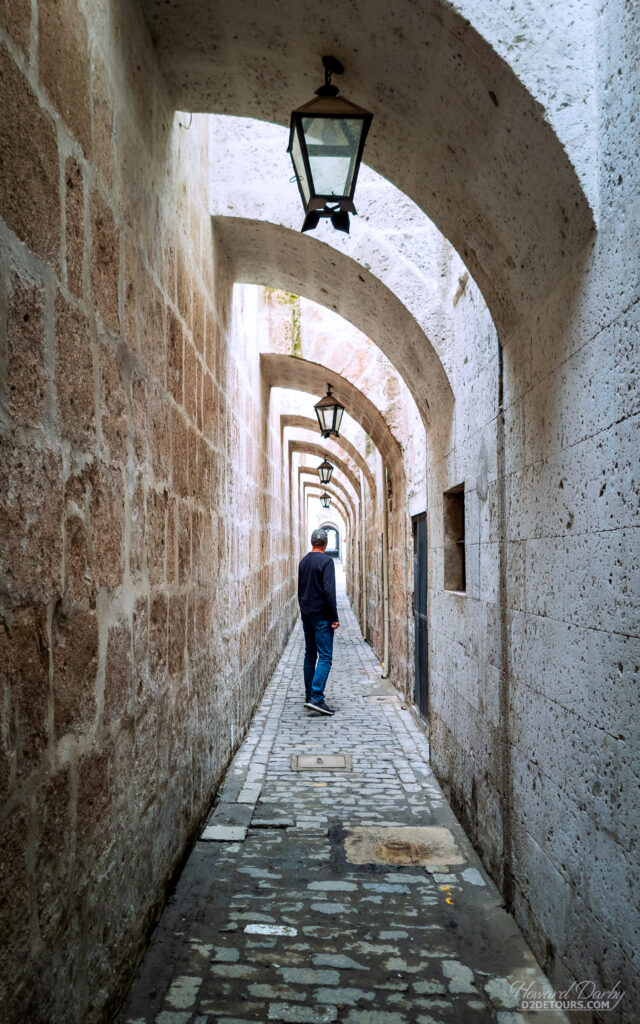
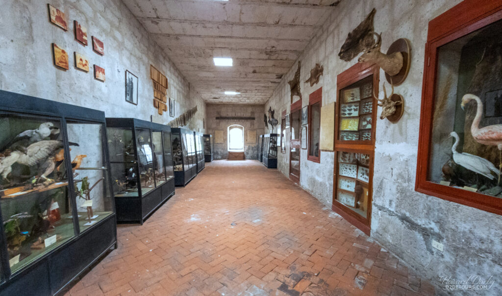
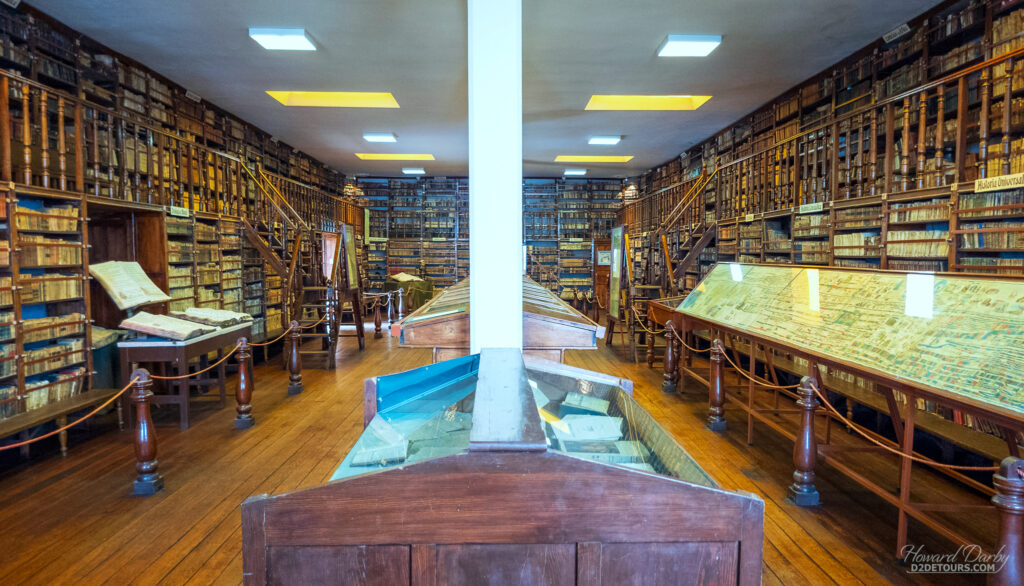
The most interesting building we visited in Arequipa was the Recoleta Convent and Museum. Open as a monastery in 1648, it has been a museum since 1978 and houses an eclectic collection: a toy room, religious art and artifacts (Catholic) rooms, a numismatic room, a musty taxidery room filled with Peruvian jungle fauna, and several rooms of Pre-Columbian artifacts the missionaries collected whilst spreading the word of God. In addition to the museum, there is a gorgeous library of nearly 25,000 volumes dating from the 16th, 17th, and 18th centuries.
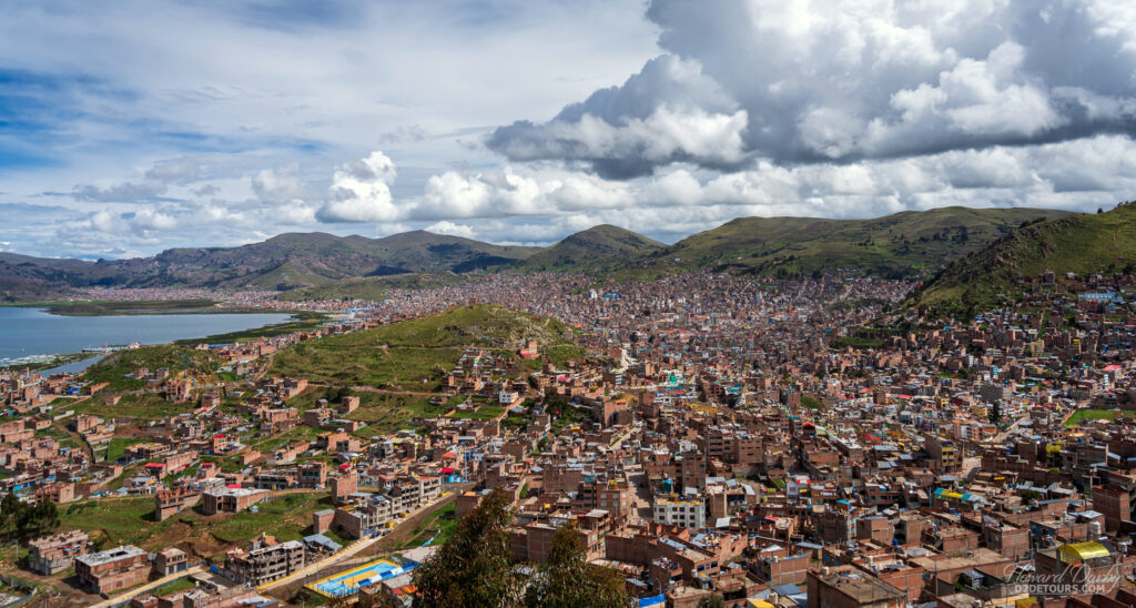
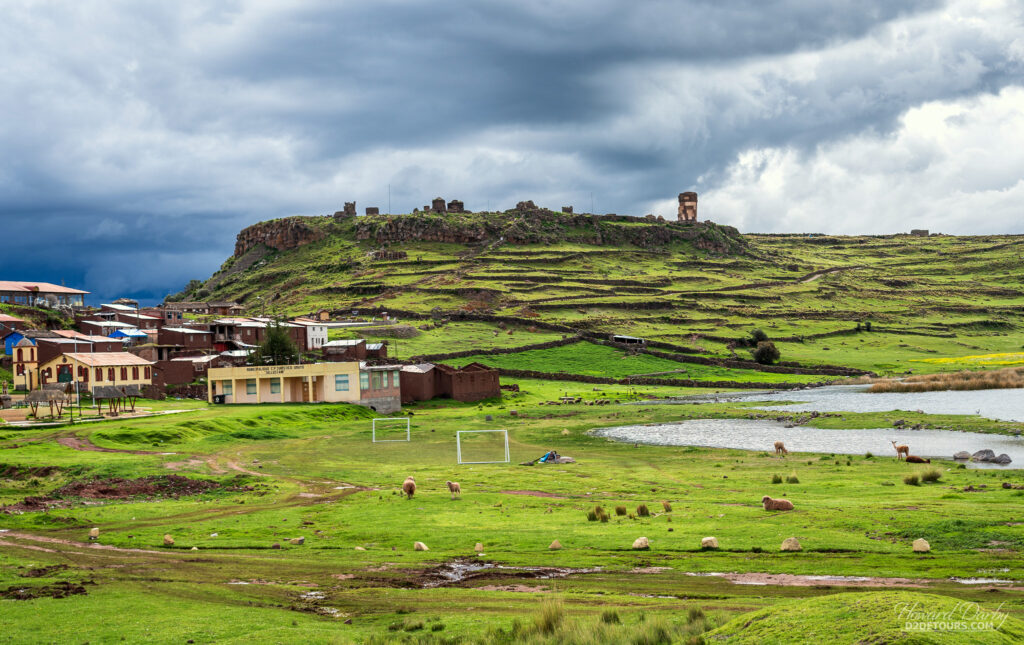
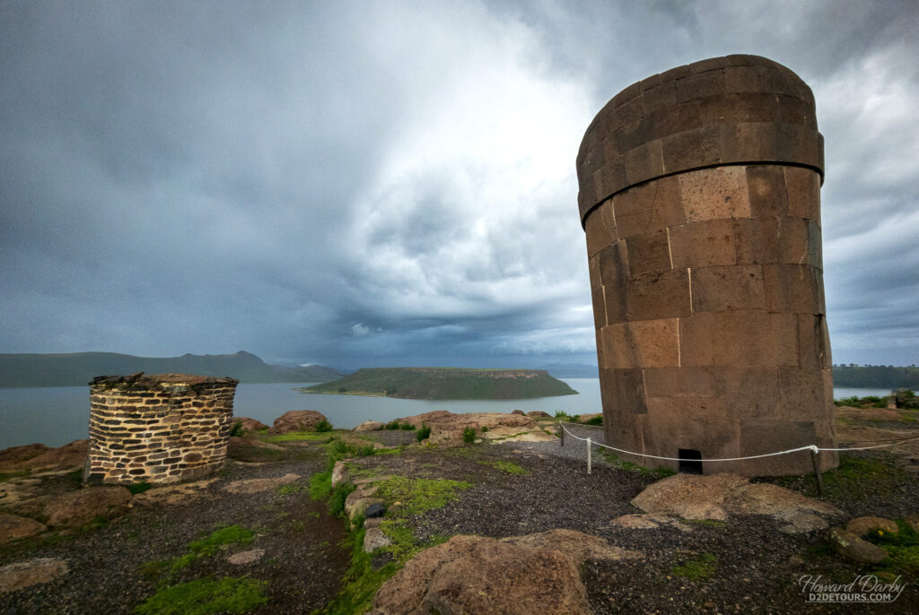
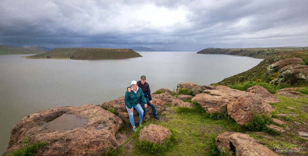
After Arequipa, we hopped back on the bus for the trip to Puno, one of the highest cities in Peru with an elevation of 3,827 m / 12,555 ft. We spent one night there and took advantage of one of the paid excursions offered by PeruHop to Sillustani, a pre-Inca cemetery about 34 km / 22 miles outside the city limits. Sillustani is perched above the Umayo lagoon and features 90 chullpas, funerary towers dating from the 13th to 15th centuries. These were burial chambers for the Aymara elite and their extended families, and while mummification was not part of the entombment process, the climate created inside these enclosed tombs inadvertently preserved the corpses over the ensuing centuries.

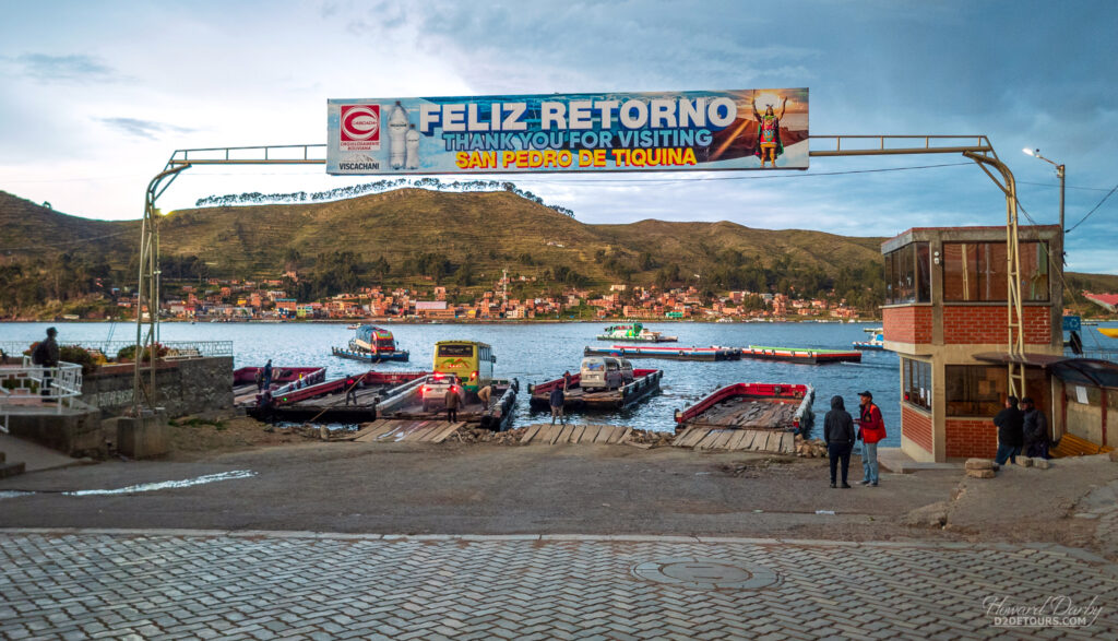
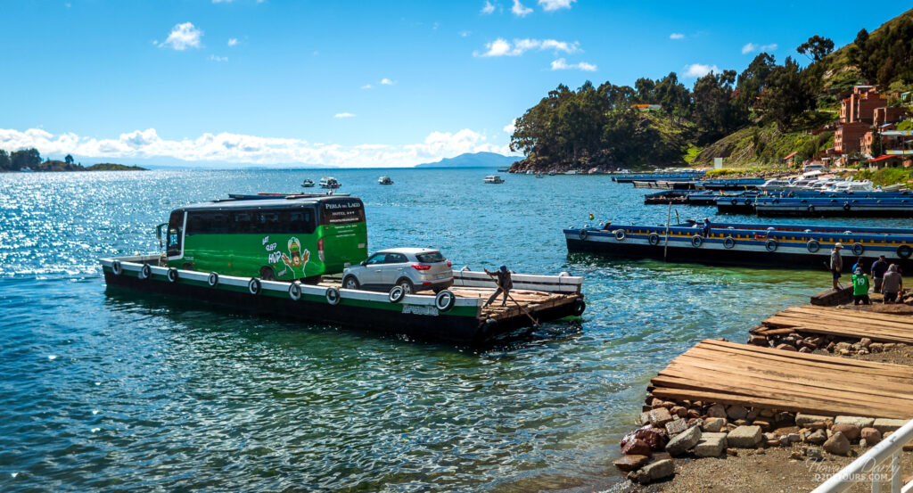
After Puno we headed to the Bolivian border where we had to disembark from the Peruhop bus, walk across the border, pass through immigration control (which I must say was a breeze for Canadians – Americans have to provide all sorts of additional documentation, including proof of income!) and then we boarded a BolviaHop bus bound for La Paz.
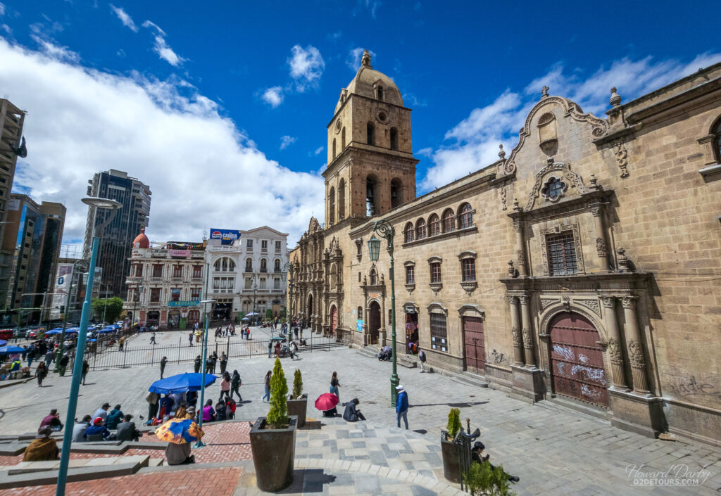
The Spanish entered the region of what is now known as Bolivia in 1535. In 1548, they discovered the remains of an Inca settlement that was “surprisingly” ideally positioned on a natural trade route connecting this landlocked territory with the route to Lima. A new Spanish city was founded and named La Paz (The Peace) to commemorate the end of the Peruvian civil wars.
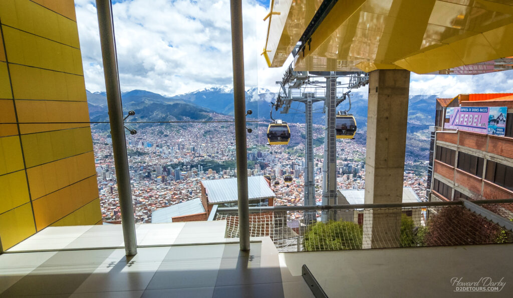
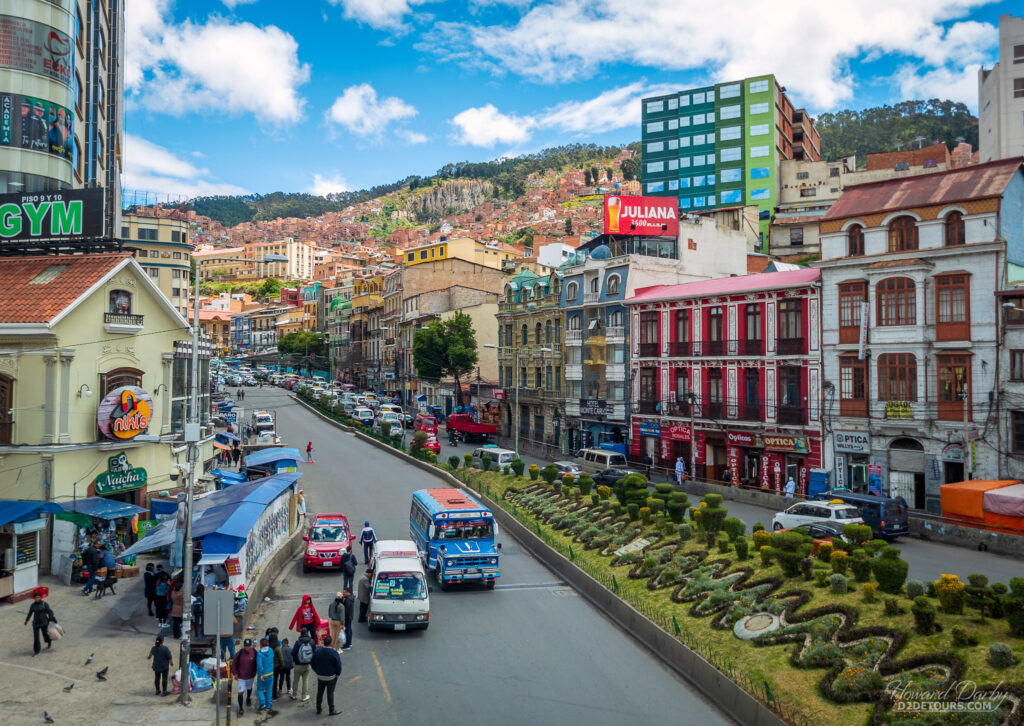
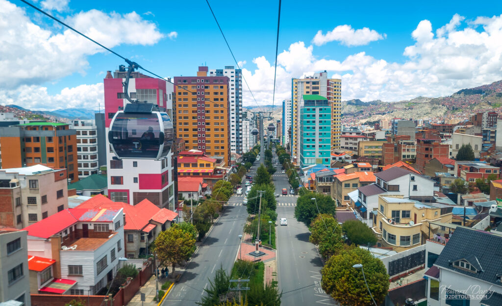
La Paz, the highest capital city in the world, is situated in a canyon with elevations ranging from 3,250 m / 10,660 ft to 4,100 m / 13,450 ft. Its social differences are reflected in that altitude: the most affluent residents live in the lower, southwest section of the Prado, the middle-class live in high-rise condos near the city center, and the lowest classes fill makeshift red brick buildings climbing higher and higher into the hills. The altitude is no joke – despite feeling like you’re moving in slow motion, you’re still constantly short of breath. We marveled at the conditioning of the locals as they rapidly moved past us on the streets, often with their arms laden with groceries and going uphill!

One of the best ways to truly appreciate the geography is to take a round trip ride on Mi Teleférico (my cable car). As of 2019, this cable car system consists of 26 stations along ten lines, with additional lines and extensions still in the works. Our tickets were about $2 CAD/pp ($1.40 USD) to ride the entire circuit, with the trip lasting a little over an hour – a very cool birdseye view of the city.
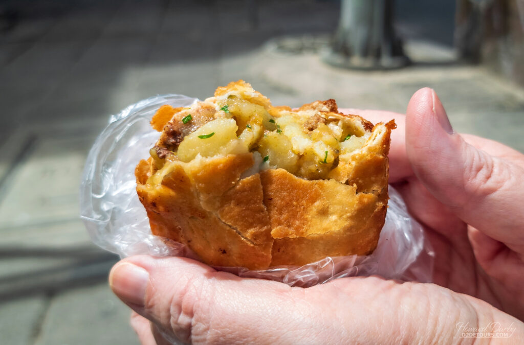
Fun Fact: Bolivia is a difficult market for North American fast food restaurants. That’s not surprising when you can grab salteñas (the Bolivian version of an empanada) packed with a slightly spicy mix of beef, chicken, potatoes, olives, raisins, and occasionally egg for less than a buck on just about any street corner. McDonald’s has 40,000 stores in 114 countries/territories and opened the first of its eight stores in Bolivia in 1997. Poor sales forced the closure of all those stores just five years later. Fried chicken is hugely popular in Bolivia due in part to the unique taste and texture of a “high-altitude” bird. KFC, with nearly 32,000 restaurants in 150 countries/territories worldwide, has a single franchise in Santa Cruz de la Sierra (opened in 2014) and is struggling to gain a market share against the popular Bolivian chain Pollos Copacabana, which we tried and may have given me food poisoning.
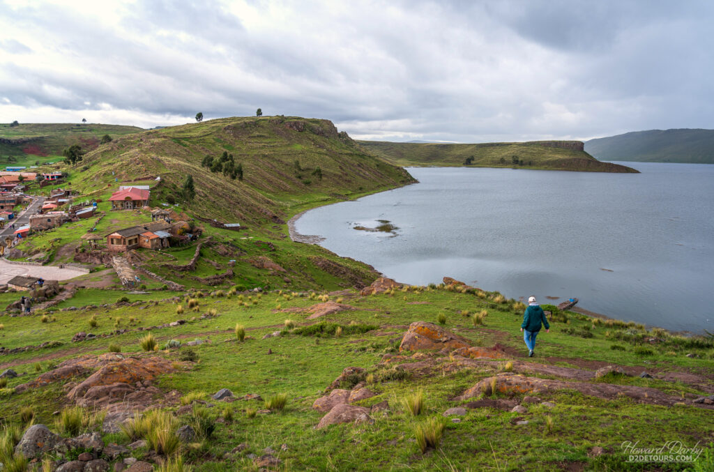
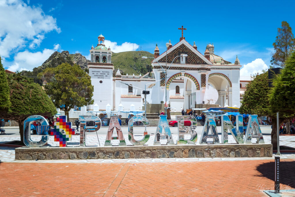
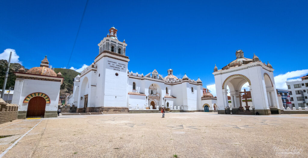
On our way back to Peru we stopped for the afternoon in Copacabana on the shores of Lake Titicaca, the highest navigable lake in the world (3,812 m / 12,507 ft) straddling both Peru and Bolivia. UNESCO lists it as “one of less than twenty ancient lakes on earth, and is thought to be three million years old.”
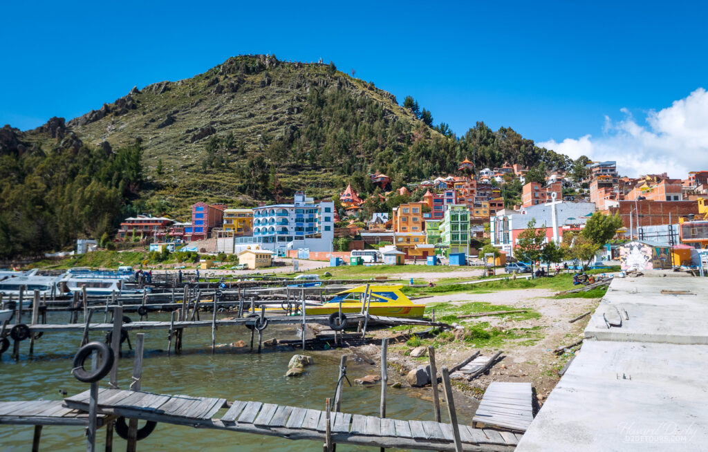
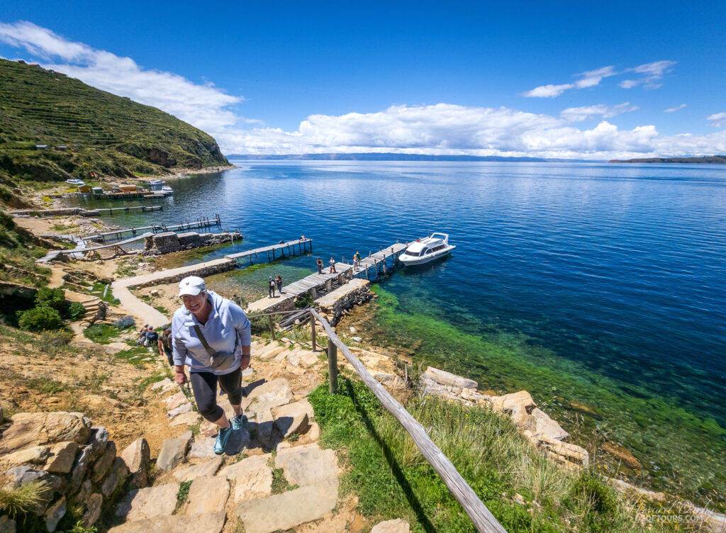
Numerous islands (both man-made and natural) dot Lake Titicaca, and we took a trip out to Isla del Sol (Island of the Sun) one of the largest islands, and home to Inca ruins dating from the 15th century. Sadly, none of these ruins are located along the shoreline, necessitating a hike up about 200 m / 650 ft, taking us to over 4,000 m / 13,000 ft – I’m gasping again just thinking about it.
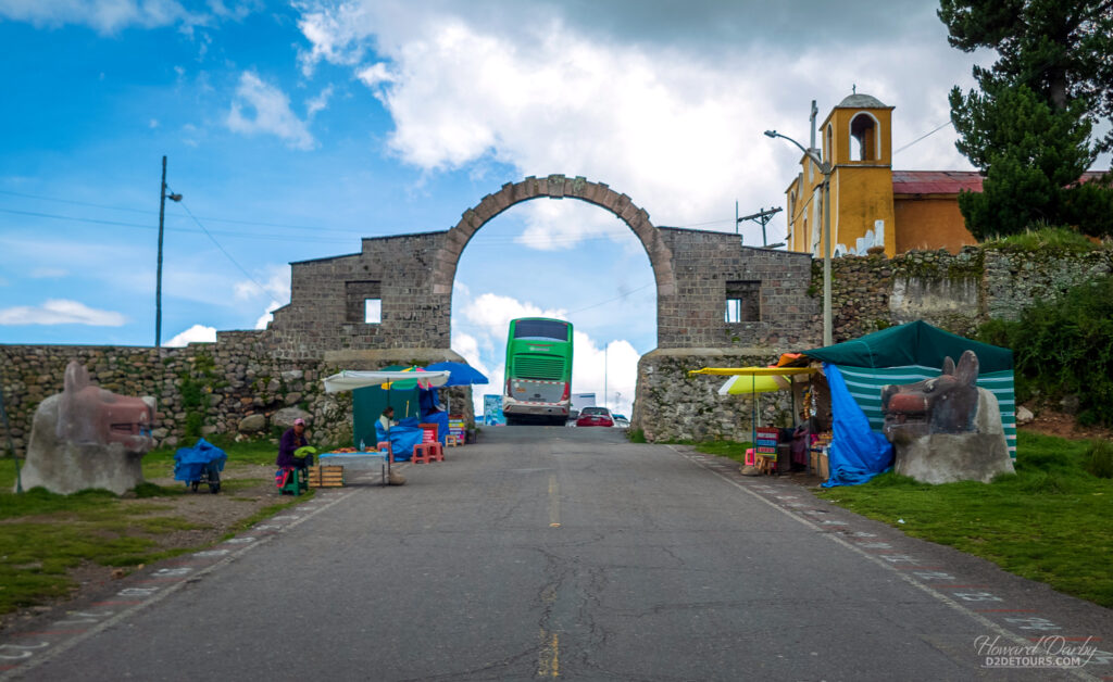
Our PeruHop journey finished in Cusco, the gateway to Machu Picchu. Most English (or European) speakers, myself included, are probably more familiar with the Cuzco spelling rather than Cusco. Both are correct, but the Quechua language, from which the city’s name is derived, does not have a “z” sound, making Cusco a more accurate reflection of the original pronunciation and the preferred spelling in Peru.
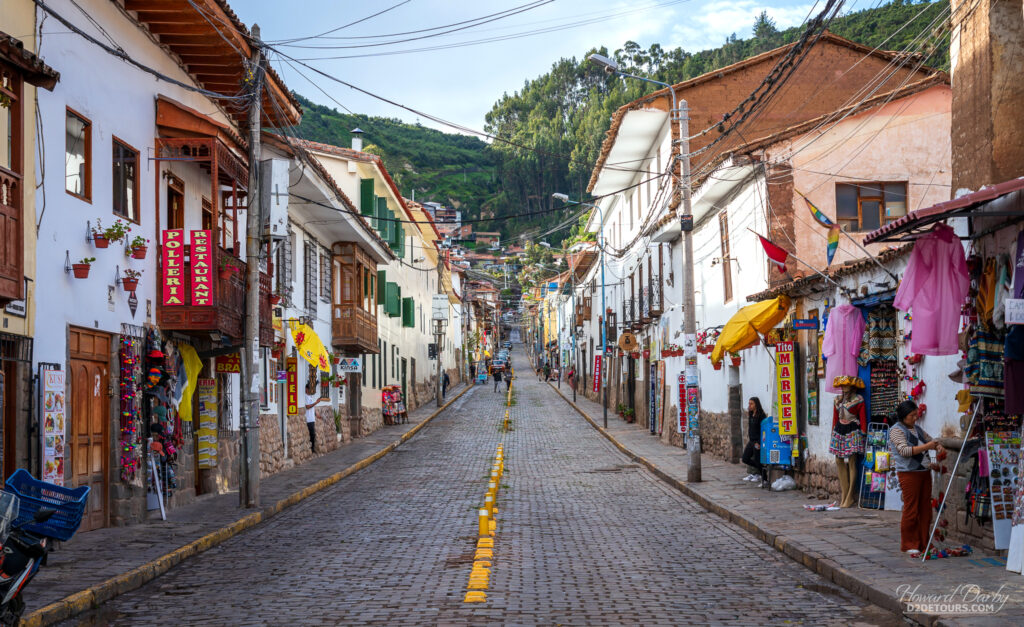
Cusco was the capital of the Inca Empire and was divided into four quadrants, representing the four provinces of the Empire. Territorial leaders within each of the provinces were required to build a home in the corresponding Cusco quarter and live there for part of the year. When the Spaniards arrived in the Inca capital in the 16th century they were astonished at the length and regularity of the streets, and were captivated by the sophistication and beauty of the buildings’ stonework.
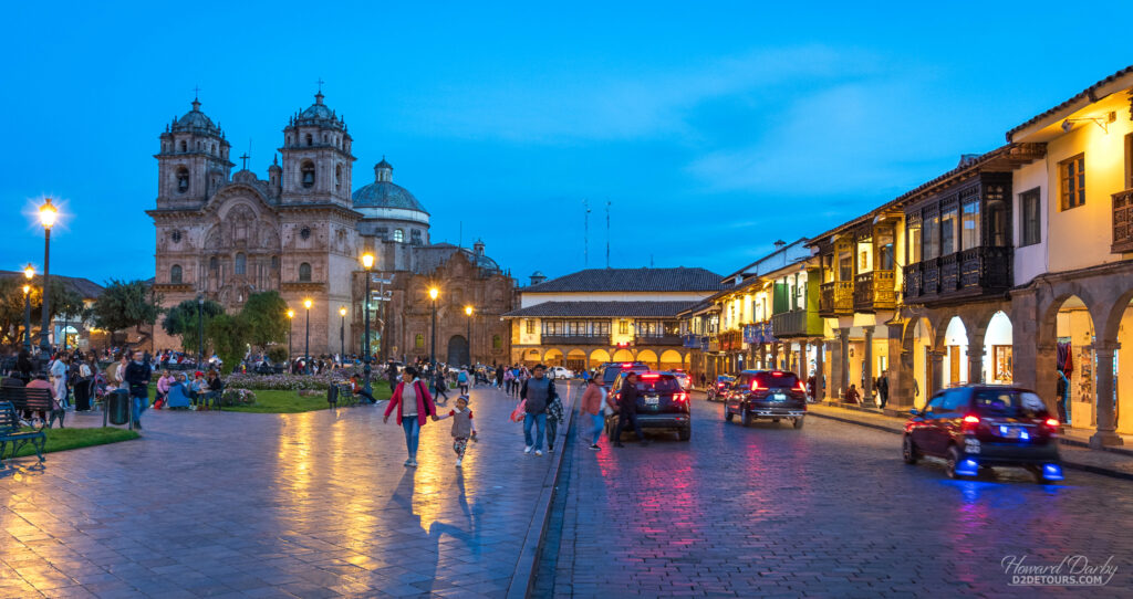
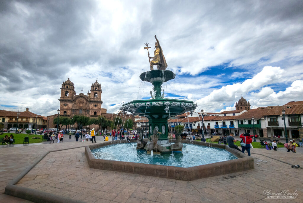
After a few years the Inca army had been thoroughly routed, and the conquistadors plundered, then razed, these beautiful edifices to make way for the Spanish aesthetic. Cusco is a charming city in its own right, but it is probably best known as the gateway to Machu Picchu.
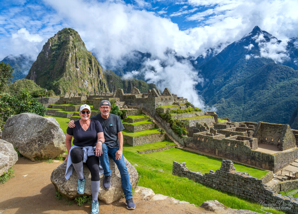
We did a two-day tour to the iconic sanctuary of Machu Picchu, and left the logistics to Yapa Explorers. We took a shuttle bus from Cusco to Ollantaytambo, where we then boarded a train to Aguas Calientes.
We overnighted in Aguas Calientes and then caught an early morning bus (together with a guide) up to the citadel. That bus ride is about 20 minutes. If you’re so inclined, you can hike a 1600-step (3 km / 2-mile) path to the top, and allowing yourself at least an hour to complete the route is recommended. Bear in mind you are already at 2,040 m / 6,693 ft in Aguas Calientes, with the elevation gain to the citadel another 542 m / 1,778 ft – the young guy in our tour group of five (like under 30 young, and fit) who elected to hike up, arrived exhausted and confessed he wasn’t sure he was going to make it; the bus was air-conditioned and lovely.
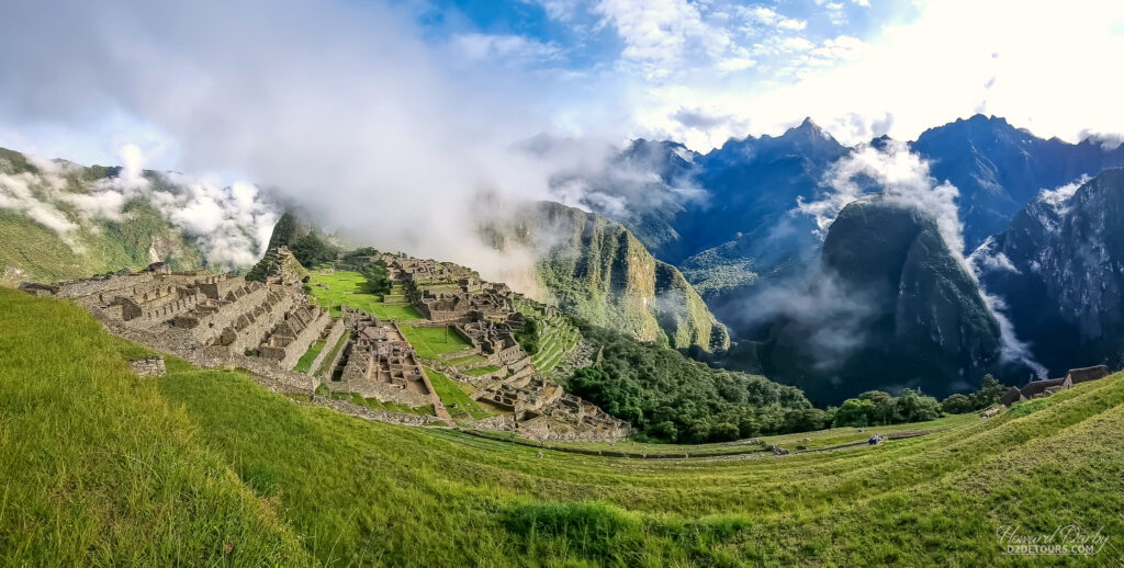
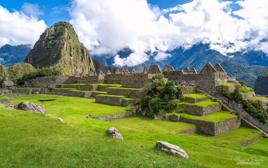
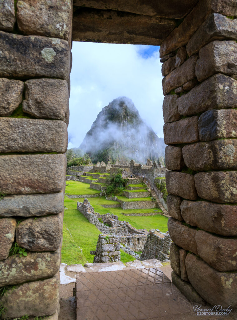
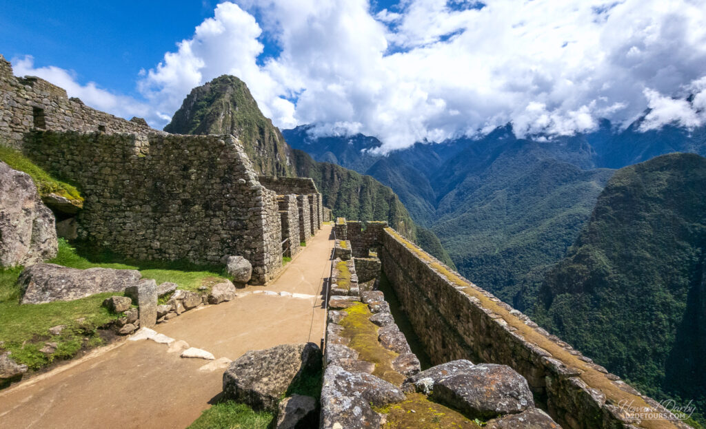
There is always a risk that highly touristed attractions won’t live up to their hype; Machu Picchu did not disappoint. There is something indescribably magical about gazing upon these ruins against the lush green mountainous backdrop. No written record exists detailing this site nestled between the peaks of Machu Picchu (old summit or peak) and Huayna Picchu (young summit/peak). The Inca civilization did not have a written language, and (fortunately) the Spanish never discovered it, which explains why 75% of the buildings remain in their original state.
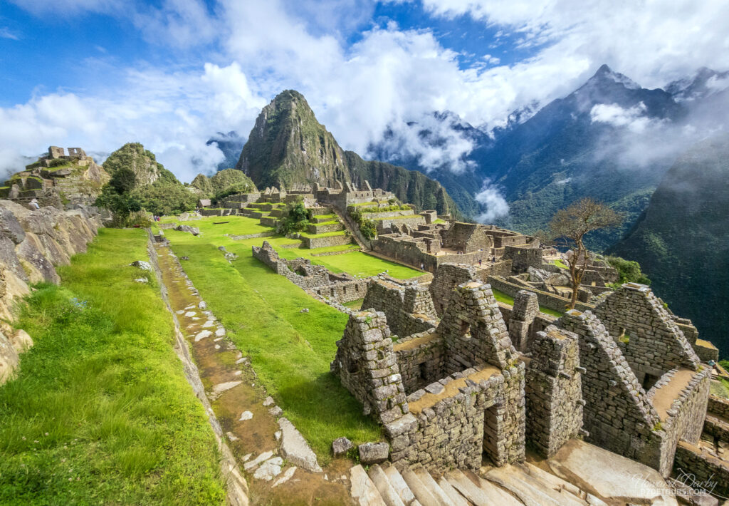
The prevailing theory is that this “lost city” was a royal retreat, not a permanent settlement. Built in the classical Inca style with polished dry-stone walls, radiocarbon dating estimates it was occupied from 1420-1532 CE. Its “abandonment” coincides with the arrival of the Spanish.
While the local population was certainly aware of its existence, it was Hiram Bingham, as part of an expedition sponsored by the National Geographic Society and the Peruvian government, who brought it worldwide attention in 1911. The supposed uses and names assigned to the various buildings, and the site name itself, are attributable to that expedition.
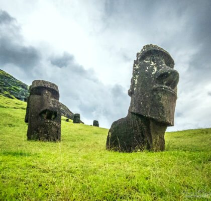
Travelling with PeruHop (and BolviaHop) was a fabulous, hassle-free way to discover these two countries, and we would totally recommend them. Off to Easter Island!
Looks like it was an amazing adventure! Thanks so much for sharing.
Pingback: Howard's Favourite Photos From 2025 - D2 Detours